
Antonio Nariño Airport
Chachagüí, Colombia

Antonio Nariño Airport
Gateway to Pasto and Colombia's southern Andean region.
- ›Named after Antonio Nariño, a hero of Colombian independence.
- ›Located in Chachagüí municipality, about 35 km northeast of Pasto.
- ›Sits at approximately 1,800 metres (5,906 feet) above sea level.
- ›Surrounded by Andean terrain, making approaches technically challenging.
- ›Serves as the main commercial airport for Nariño Department.
Antonio Nariño Airport, coded PSO, serves the city of Pasto and the Nariño department from its location in the town of Chachagüí, approximately 35 kilometres north of the regional capital. Named after the Colombian independence hero Antonio Nariño, the airport sits at an elevation of roughly 1,800 metres in a valley flanked by the Andes, making it a strategically important hub for southwestern Colombia. It handles domestic routes connecting Nariño to Bogotá and other major Colombian cities, serving as a vital lifeline for a region where mountain terrain makes road travel challenging.
- Main Terminal — A single compact domestic terminal handling all passenger check-in, arrivals, and departures with basic commercial and security facilities.
- Taxis available at the terminal exit for the 35 km journey to Pasto city centre
- Shared colectivo minivans connecting the airport to Pasto and nearby towns
- Private transfer services bookable in advance through local operators
- Rental car desks available at the terminal for self-drive options
- Hotel Cuellar's Pasto
- Hotel Dann Monasterio Pasto
- Hotel Agualongo Pasto
- Koala Inn Pasto
Inside the terminal, food options are limited to a small café and snack counter offering Colombian staples such as empanadas, arepas, and hot drinks. Travellers with time before their flight are advised to eat in Pasto, where the local cuisine features hearty Andean dishes including cuy, papas chorreadas, and caldo de costilla. The road between Chachagüí and Pasto passes through small towns with roadside eateries serving affordable regional food.
- Allow extra travel time for the winding mountain road between Pasto and the airport, especially during rainy season when landslides can cause delays.
- Arrive at least 90 minutes before domestic departures, as check-in queues can build quickly during peak travel periods.
- The airport sits at altitude; visitors unaccustomed to elevations above 1,800 metres may experience mild altitude symptoms upon arrival.
- Currency exchange facilities are minimal at the airport, so carry Colombian pesos before departing Pasto.
AI-assisted overview, verified against public sources.
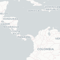
Route map (2 destinations)




Airlines serving this airport
Routes
Aircraft operating here
Pick what matters for your layover or early flight, then compare on your favorite booking site.
IndianAirports may receive compensation when you book or purchase through some of the links on this page, at no additional cost to you. Prices and availability are set by the booking provider and may change. We never share your private trip details with partners — only the destination, dates and party size you searched.
City & Place Guide
No guide exists for this place yet — Click to generate a Traveler Pulse guide.
Passport, Visa & Immigration
Flying internationally via PSO? Check entry, transit and customs requirements for Colombia from official government sources.

Antonio Nariño Airport is an airport located in the town of Chachagüí and which serves the city of Pasto in the Nariño Department of Colombia. The airport is 35 kilometres (22 mi) north of Pasto. It handles only domestic flights in addition to military operations and private charters. A new terminal, administrative and tower control were built, also new navigation equipment was set up due to the increasing number of passengers and cargo flights. Usually Airbus 318, 319, 320, Boeing 737, 727, turboprop and different types of smaller aircraft use the airport
Read full article on Wikipedia