Translate
Overview
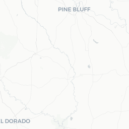
Wrightsville is a small incorporated city in Pulaski County, Arkansas, situated roughly 12 miles southeast of downtown Little Rock. With a population of approximately 2,260, it functions primarily as a residential community within the Little Rock metropolitan area rather than a standalone travel destination.
The surrounding landscape is characteristic of Central Arkansas — gently rolling terrain, mixed pine and hardwood woodland, and bottomland near the Arkansas River corridor. Visitors typically encounter Wrightsville as a pass-through point or a quiet base while exploring the broader Little Rock region.
Because of its size, Wrightsville lacks the commercial infrastructure — hotels, restaurants, and attractions — of a conventional travel destination. Most practical needs are met in Little Rock or nearby Sherwood. Travelers with an interest in small-town Arkansas life or those visiting residents locally will find it a calm, unpretentious community.
Before You Go
Visas & Entry
Wrightsville is in the United States. For visa and entry requirements, visit TravelerPulse's Visas section and check directly with the U.S. Customs and Border Protection or the official embassy of the United States in your home country.
What to Pack
- Arkansas summers (June–August) are hot and humid; lightweight, breathable clothing is essential
- Winters can bring occasional ice storms; layers and a warm jacket are advisable November through February
- Insect repellent is useful in spring and summer, particularly near wooded or low-lying areas
- A personal vehicle is strongly recommended — public transit options are very limited in this area
Health
No destination-specific health precautions are required beyond standard travel wellness practices. Verify current U.S. entry health requirements if traveling internationally.
Getting There
By Air
The nearest commercial airport is Bill and Hillary Clinton National Airport (LIT) in Little Rock, approximately 15 miles northwest. LIT is served by several major U.S. carriers and offers connections through hub cities. Verify current routes and schedules directly with airlines or the airport.
By Road
Wrightsville is accessible via U.S. Highway 165, which runs through the community. Interstate 530 lies nearby, connecting to Little Rock to the north and Pine Bluff to the south. Driving is the most practical way to reach and navigate the area.
By Bus
Greyhound service operates into Little Rock. Local transit connections from Little Rock to Wrightsville are limited; verify current options with the Central Arkansas Transit Authority (CATA) before travel.
Getting Around
A personal vehicle is effectively necessary for getting around Wrightsville and exploring surrounding areas. Roads are straightforward, and Little Rock's amenities — grocery stores, gas stations, restaurants, and entertainment — are within a short drive.
Ride-hailing apps such as Uber and Lyft operate in the greater Little Rock metro area; availability in Wrightsville specifically may be limited depending on time of day. Verify coverage before relying on these services.
Things to See & Do
Wrightsville itself has limited dedicated visitor attractions given its small size. Most points of interest are in the surrounding region.
- Outdoor recreation: The Arkansas River and its adjacent lands offer fishing, birdwatching, and nature walks. Check with the Arkansas Game and Fish Commission for current access points and regulations.
- Day trips to Little Rock: The Arkansas State Capitol, Little Rock Central High School National Historic Site, the Clinton Presidential Center, and the Arkansas Museum of Fine Arts are all within roughly 20–25 minutes by car.
- Lake Maumelle and Pinnacle Mountain State Park: Located west of Little Rock, these offer hiking, paddling, and scenic views — accessible as a day trip.
- Pine Bluff: To the south via U.S. 530, Pine Bluff has its own cultural sites and the Arkansas Entertainers Hall of Fame; verify hours locally.
Food & Drink
Dining options within Wrightsville proper are very limited. Travelers should plan to eat in Little Rock, Sherwood, or along the U.S. 65 corridor for a wider selection.
Central Arkansas has a strong tradition of Southern cooking — expect barbecue, catfish, fried chicken, and comfort-food diners. Little Rock's dining scene has grown considerably in recent years and includes options across many price points and cuisines. Verify hours and current operation before visiting any specific restaurant, as small local establishments can have irregular schedules.
Practical Information
Emergency Services
For any emergency in the United States, dial 911. Pulaski County Sheriff's Office and Arkansas State Police both serve this area. The nearest major hospitals are in Little Rock; verify the closest facility to your location upon arrival.
Connectivity
Cell coverage from major U.S. carriers (Verizon, AT&T, T-Mobile) is generally available in and around Wrightsville. Wi-Fi will typically need to be secured through your accommodation, which in practice means Little Rock-area hotels.
Shopping & Supplies
There are no large retail centers within Wrightsville. Grocery stores, pharmacies, and general retail are available in Little Rock and along the nearby highway corridors. Stock up before arriving if you plan to stay locally.
Currency & Payments
The US Dollar is the only currency used. Credit and debit cards are accepted nearly everywhere in the region. ATMs are available in Little Rock.
Safety
Wrightsville is a quiet residential community. As with any area, basic travel awareness — securing valuables, being mindful of your surroundings after dark, and locking vehicles — is advisable.
Arkansas is part of the central U.S. tornado corridor. Spring and, to a lesser extent, fall can bring severe thunderstorms and tornado watches. Monitor the National Weather Service (weather.gov) during these seasons and know the location of the nearest shelter. Flash flooding is also possible during heavy rain events, particularly in low-lying areas near the river.