Translate
Overview
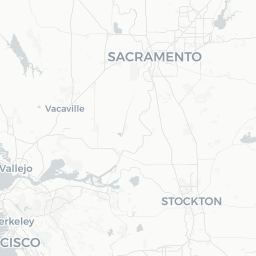
Marysville is a small city in Yuba County, Northern California, situated at the confluence of the Feather and Yuba rivers, roughly 50 miles north of Sacramento. With a population of around 12,000, it punches above its size in historical significance — it was one of the most important supply and trading hubs during the California Gold Rush of the 1850s, and for a time ranked among the largest cities in the state.
Today Marysville retains much of its 19th-century built character, with a compact historic downtown featuring brick storefronts that recall its boom years. It is also notable for having one of the longest-established Chinese-American communities in California, a legacy visible in the Bok Kai Temple and the annual Bok Kai Festival, believed to be the oldest continuously celebrated Chinese festival in the United States.
For travelers, Marysville works well as a half-day or full-day stop on a broader Northern California road trip, or as a quiet base for exploring the lower Feather River, nearby state parks, and the Sierra Nevada foothills. It is an honest, unpretentious place that rewards curious visitors willing to look beyond the surface.
Before You Go
Visas
Marysville is in the United States. Visa requirements vary significantly by nationality. Check TravelerPulse's Visas section and the U.S. Customs and Border Protection website for current, authoritative information before booking.
Climate
Marysville has a hot Mediterranean climate. Summers (June–September) are long and dry, with temperatures frequently exceeding 95°F (35°C) and occasional triple-digit heat. Winters are mild but can bring valley fog (locally called 'tule fog') that significantly reduces visibility and makes driving hazardous. Spring and fall offer the most comfortable conditions for sightseeing and outdoor activity.
What to Pack
- Light, breathable clothing for summer visits; a warm layer for winter evenings
- Sun protection (hat, sunscreen, sunglasses) is essential in summer
- If visiting in winter, be prepared for fog and keep travel flexible
- There are no large shopping malls in Marysville, so stock up on specialty items before arriving
Getting There
By Car
Marysville is the most straightforward destination to reach by car. It sits along Highway 70 and is accessible via California State Route 20. From Sacramento, the drive is approximately 50 miles north on Highway 99 or I-5, then connecting roads — roughly 50–60 minutes depending on traffic. From the Bay Area, allow 2.5–3 hours.
By Bus
Greyhound and Yuba-Sutter Transit provide regional bus connections. Verify current routes, schedules, and stops on the Yuba-Sutter Transit website or locally, as service patterns can change.
By Train
The nearest Amtrak station with regular service is in Sacramento or Chico. There is no direct Amtrak stop in Marysville itself. From either station, a connecting bus or rental car would be needed to complete the journey. Verify current Amtrak schedules at amtrak.com.
By Air
The closest major airport is Sacramento International Airport (SMF), approximately 50 miles south. Reno-Tahoe International Airport (RNO) is a secondary option for travelers coming from the east, roughly 100 miles away.
Getting Around
Marysville's historic downtown is compact and walkable. Most sites of visitor interest — the Bok Kai Temple, Ellis Lake, downtown storefronts — can be covered on foot once you are parked or dropped off.
For travel outside the immediate downtown core, a car is essentially necessary. Public transit within the city and to neighboring Yuba City (just across the Feather River) is provided by Yuba-Sutter Transit; verify current routes and schedules locally or on their official website.
Ride-share availability (Uber, Lyft) exists but may be limited compared to larger cities — verify availability in the app before relying on it for time-sensitive trips.
Things to See & Do
Bok Kai Temple
Built in 1880, the Bok Kai Temple on the Marysville riverfront is one of the oldest Chinese temples remaining in California and a National Historic Landmark. It is dedicated to Bok Eye, the water deity, and remains an active place of worship. Visiting hours and access protocols vary; check locally before visiting and be respectful of any religious observances in progress.
Bok Kai Festival (Bomb Day)
Held annually in late February or early March, the Bok Kai Festival is a major community celebration featuring a parade, firecrackers, and the famous 'bomb day' tradition in which coiled firecrackers are launched into the air and retrieved for luck. It draws visitors from across California and is considered one of the most distinctive cultural festivals in the state. Verify dates each year through local event listings.
Ellis Lake
Ellis Lake is a landscaped urban lake near downtown, surrounded by walking paths and parks. It's a pleasant spot for a morning stroll or picnic, and the area hosts community events throughout the year.
Historic Downtown
The downtown district preserves a notable collection of 19th-century commercial brick architecture. A self-guided walk along D and E Streets gives a tangible sense of what a Gold Rush-era Northern California trading town looked like at its peak.
Feather River and Yuba River Access
The confluence of these two rivers offers fishing, bird-watching, and riverside walking. The rivers are popular with local anglers (fishing license required — verify current California Department of Fish and Wildlife regulations). Swimming conditions vary seasonally and are affected by water levels; always check conditions locally before entering the water.
Food & Drink
Marysville's dining scene is modest and locally oriented. The city has a range of casual restaurants, taquerias, and diners, reflecting its diverse community. There is no significant fine-dining scene, but visitors will find solid everyday eating options.
The city's Chinese-American heritage means there are some long-standing Chinese restaurants in and around downtown, though individual businesses open and close — verify current options through Google Maps or Yelp before visiting.
Neighboring Yuba City, just across the Yuba River via the 5th Street Bridge, expands dining options considerably and has a notably large South Asian community, so Indian and Punjabi restaurants are well represented in the broader area.
Grocery stores and markets are available for self-catering. Verify hours locally.
Practical Information
Emergency Services
For any emergency in the United States, dial 911.
Money
Most businesses accept major credit and debit cards. ATMs are available in the downtown area. It is worth carrying a small amount of cash for smaller establishments or farmers' markets.
Connectivity
Mobile coverage from major US carriers (AT&T, Verizon, T-Mobile) is generally available in town. Free Wi-Fi may be available at the public library; verify locally.
Useful Contacts
- Yuba County Visitor information: check the City of Marysville official website for current tourism contacts
- California road conditions and fog alerts: Caltrans QuickMap (quickmap.dot.ca.gov)
Safety
Marysville is a small working city with the range of conditions typical of communities its size in California's Central Valley. Downtown and riverfront areas frequented by visitors are generally safe during daylight hours. As with any destination, be aware of your surroundings, keep valuables out of sight in parked vehicles, and use well-lit areas at night.
The most significant natural hazard in the region is flooding. Marysville and the Yuba-Feather river confluence have a documented flood history; the city is protected by levees. If visiting during heavy rain periods, monitor local news and the National Weather Service (weather.gov) for any flood watches or warnings. Tule fog in winter is a serious road-safety hazard — slow down, use low-beam headlights, and consider delaying travel if visibility is very poor.
Local Culture & Etiquette
Marysville's cultural identity is shaped by successive waves of migration. The Gold Rush brought a globally diverse population in the 1850s, and Chinese immigrants established a community that has persisted for over 170 years — longer than almost anywhere else in California. The Bok Kai Temple and its associated festival are living expressions of that continuity.
More recently, Marysville and the wider Yuba-Sutter area have significant Hmong and South Asian (particularly Punjabi Sikh) communities, each with their own cultural presence in local food, business, and community life. Visitors who engage with the city beyond its Gold Rush story will find a layered, genuinely multicultural small city.
When visiting the Bok Kai Temple or any cultural or religious site, dress modestly, follow any posted guidelines, and ask before taking photographs.