Overview
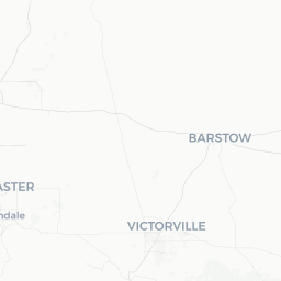
Palmdale is a mid-sized city of roughly 158,000 people situated in the western Antelope Valley, part of the Mojave Desert at an elevation of around 2,600 feet (790 m). It sits about 60 miles north of downtown Los Angeles via the Antelope Valley Freeway (SR-14), making it both an independent community and a distant suburb of the LA metro area.
The city's identity is closely tied to aerospace. Lockheed's legendary Skunk Works facility is headquartered nearby at Air Force Plant 42, and the region has been central to American aviation and defense development for decades. This heritage gives Palmdale a grounded, working-community character distinct from coastal Southern California.
Beyond industry, the high desert setting offers travelers open skies, dramatic terrain, and — in the right season — one of California's most striking natural spectacles: the blooming of native wildflowers across the Antelope Valley. Visitors who time their trip to spring often find rolling hills carpeted in California poppies and other native plants, a sight that draws photographers and nature enthusiasts from across the state.
Before You Go
Visas
Palmdale is located in the United States. For visa requirements, check TravelerPulse's Visas section and the official US Customs and Border Protection website or the US Embassy or Consulate serving your country.
Climate
Palmdale has a semi-arid high-desert climate. Summers are hot, with temperatures frequently exceeding 100°F (38°C). Winters are cool to cold, with occasional freezing nights and rare light snowfall. Spring and autumn are the most comfortable seasons for outdoor activity. The city receives considerably less rainfall than coastal California, and the air tends to be dry year-round.
What to Pack
- Sunscreen and a wide-brimmed hat (UV exposure is intense at elevation)
- Layers for cool mornings and evenings, even in summer
- Comfortable walking or hiking shoes
- Water bottle — carry more water than you think you need in desert conditions
- Camera gear if visiting during wildflower season (March–April)
Getting There
By Car
Driving is the most practical way to reach Palmdale. From downtown Los Angeles, take the I-5 north to SR-14 north; the drive takes roughly 60–90 minutes depending on traffic. Traffic through the San Fernando Valley and the Newhall Pass can be heavy during peak commute hours.
By Train (Metrolink)
Metrolink's Antelope Valley Line connects Palmdale to Union Station in downtown Los Angeles. Service runs multiple times daily on weekdays with limited weekend schedules. Verify current schedules and fares at metrolinktrains.com before travel. The Palmdale Metrolink Station is centrally located.
By Air
Palmdale Regional Airport (PMD) offers limited scheduled commercial service; verify current carriers and routes before planning. Los Angeles International Airport (LAX) and Bob Hope Airport in Burbank (BUR) are larger alternatives with far more connections, though both require driving into the metro area before heading north.
Getting Around
A personal vehicle or rental car is strongly recommended for getting around Palmdale. The city is spread out with a suburban layout, and most attractions, shopping centers, and restaurants are not easily walkable from one another.
Antelope Valley Transit Authority (AVTA) operates local bus routes throughout Palmdale and to neighboring Lancaster. AVTA also runs an express commuter bus service to the Metro system in the San Fernando Valley. Check avta.com for current routes, schedules, and fares.
Rideshare services (Uber, Lyft) are available in Palmdale but coverage can be less dense than in larger urban areas. Wait times may be longer, particularly late at night or in outlying parts of the city.
Things to See & Do
Antelope Valley California Poppy Reserve
Located about 15 miles west of Palmdale near Lancaster, this California State Reserve is the destination for spring wildflower viewing. The reserve protects one of the largest remaining stands of native California poppies. Peak bloom typically occurs between late February and April, though the exact timing varies significantly by year depending on rainfall. Check the reserve's official California State Parks page for current bloom conditions before making a special trip.
Air Force Flight Test Museum (Edwards AFB)
Edwards Air Force Base, southeast of Palmdale, houses this museum dedicated to the history of flight testing in the Mojave Desert — the same skies where Chuck Yeager broke the sound barrier. Note that access to Edwards AFB requires advance planning; verify current public access policies and tour availability directly with the base before visiting.
Palmdale Amphitheater
The Palmdale Amphitheater hosts outdoor concerts and community events, particularly in warmer months. Check the city of Palmdale's official events calendar for current programming.
DryTown Water Park
A seasonal family-oriented water park operating during the summer months in the Palmdale area. Verify current operating status, hours, and pricing before visiting.
Hiking and Outdoor Recreation
The surrounding high desert and the nearby San Gabriel Mountains offer accessible hiking and outdoor recreation. Devil's Punchbowl Natural Area, a Los Angeles County park located in the mountains south of Palmdale, features striking geological formations and trails. Check LA County Parks for current conditions.
Food & Drink
Palmdale's dining scene is largely casual and reflects the city's diverse, working-community population. You'll find a solid range of Mexican restaurants and taquerias — a reflection of the region's large Latino community — alongside American chain restaurants, fast food, and a growing number of independent eateries.
The city has several commercial corridors along Palmdale Boulevard and Sierra Highway where dining options are concentrated. Independent restaurants serving American comfort food, Chinese, Filipino, and other cuisines are present across the city.
There is no notable wine region or craft beer destination within Palmdale itself, though Southern California craft breweries are accessible if you're willing to drive. Alcohol is available at restaurants and grocery stores where licensed.
Shopping
The Antelope Valley Mall is Palmdale's primary retail hub, an enclosed regional shopping mall with department stores and a range of national retail chains. It is located in the western part of the city.
Additional strip malls and big-box retail are distributed along major commercial corridors. Palmdale has most standard national chains for everyday shopping needs. Specialty or boutique retail is limited compared to larger urban areas.
Practical Information
Emergency Services
In an emergency, dial 911 for police, fire, or ambulance. The Los Angeles County Sheriff's Department serves Palmdale. Palmdale Regional Medical Center is the city's primary hospital; confirm its current address and services before travel.
Connectivity
Cellular coverage from all major US carriers is generally reliable throughout central Palmdale. Coverage may diminish in more remote desert areas outside the city.
Tipping
Standard US tipping practices apply: 18–20% at sit-down restaurants, $1–2 per drink at bars, and a few dollars per night for hotel housekeeping.
Tap Water
Tap water in Palmdale is safe to drink and meets US EPA standards.
Altitude
At roughly 2,600 feet elevation, Palmdale sits notably higher than coastal Los Angeles. Most visitors will not notice significant altitude effects, but staying well-hydrated is advisable, particularly during physical activity in summer heat.
Safety
Palmdale is a generally safe city for visitors exercising normal urban awareness. As with any mid-sized American city, exercise common-sense precautions: be aware of your surroundings, secure valuables in your vehicle, and avoid leaving expensive items visible in parked cars.
Desert safety deserves specific attention for anyone venturing into outdoor areas. Temperatures can be extreme, shade is scarce, and distances between services are significant. Always carry more water than you expect to need, let someone know your plans when hiking remotely, and check weather forecasts before outdoor excursions. Flash flooding can occur in desert washes during and after rain events.
In summer, never leave children, elderly persons, or pets in a parked vehicle. Interior temperatures can reach dangerous levels within minutes.