Translate
Overview
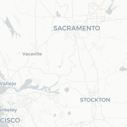
Rosemont is an unincorporated community in Sacramento County, California, situated roughly 10 miles east of downtown Sacramento. With a population of around 22,000, it functions primarily as a suburban residential area rather than a tourist destination in its own right. Visitors typically arrive here because of family ties, affordable lodging relative to downtown Sacramento, or as a convenient base for exploring the broader Sacramento region.
The community sits near the confluence of suburban Sacramento's eastern corridor, placing it within easy reach of the American River Parkway, Folsom Lake State Recreation Area, and the historic city of Folsom. Everyday life in Rosemont revolves around neighborhood parks, local dining, and community schools — giving it an authentic, unhurried character that contrasts with busier urban centers.
Travelers who do spend time here will find a practical, affordable staging point for day trips to Sacramento's museums and Capitol district, Gold Country wine trails, and the Sierra Nevada foothills.
Before You Go
Visas
Rosemont is located in the United States. Visa and entry requirements vary significantly depending on your nationality and purpose of travel. Check TravelerPulse's Visas section for general guidance and consult the official U.S. Customs and Border Protection website or your nearest U.S. embassy for requirements specific to your situation.
Climate
Rosemont has a Mediterranean climate typical of the Sacramento Valley — hot, dry summers and cool, wet winters. Summer temperatures frequently exceed 95°F (35°C), so if you visit between June and August, plan outdoor activities for early morning or evening. Winters are mild but can bring fog and intermittent rain.
What to Pack
- Sunscreen and a hat for summer visits
- A light layer or rain jacket for winter and spring
- Comfortable walking or trail shoes if you plan to use the American River Parkway
- A reusable water bottle — staying hydrated in Sacramento Valley summers is essential
Getting There
By Air
The nearest major airport is Sacramento International Airport (SMF), located approximately 20–25 miles northwest of Rosemont. SMF receives direct flights from many U.S. cities and select international destinations. Verify current routes and schedules with individual airlines or the airport's official website. From SMF, rental cars, rideshare services, and regional transit can connect you to Rosemont.
By Car
Rosemont is easily accessible by car via US-50, one of the main east-west freeways through the Sacramento region. Interstate 80 also passes nearby to the north. Most visitors driving from the Bay Area will use I-80 east or US-50 east, with Rosemont reachable in roughly 1.5–2 hours depending on traffic.
By Train
Amtrak serves Sacramento's main station (Sacramento Valley Station) downtown. From there, regional transit or a rideshare can reach Rosemont in roughly 20–30 minutes. Verify current Amtrak schedules and availability at Amtrak.com.
Getting Around
A personal vehicle or rideshare app is the most practical way to get around Rosemont and the surrounding Sacramento County area. The community is laid out as a typical American suburb with strip malls, residential streets, and limited pedestrian infrastructure connecting it to neighboring districts.
Sacramento Regional Transit (SacRT) operates bus routes that serve parts of the Rosemont area, connecting it to downtown Sacramento and other parts of the county. Check SacRT's official website for current routes, schedules, and fares, as service details change periodically.
For exploring the American River Parkway or cycling trails, Rosemont's proximity to the trail network makes a bicycle a useful option — several trailheads are reachable within a short ride. Verify local bike rental options in Sacramento or nearby Rancho Cordova.
Things to See & Do
American River Parkway
One of the region's most valued natural assets, the American River Parkway extends for more than 30 miles along the river and is accessible at multiple points near Rosemont. The paved Jedediah Smith Memorial Trail is popular with cyclists, joggers, and walkers. Access points and parking areas vary; verify current conditions with Sacramento County Regional Parks before visiting.
Folsom Lake State Recreation Area
A short drive east of Rosemont, Folsom Lake offers swimming, boating, fishing, hiking, and mountain biking across a large recreation area. Water levels fluctuate seasonally and with drought conditions, so check the California State Parks website for current access and conditions before heading out.
Historic Folsom
The city of Folsom, about 15 miles east, has a walkable historic district along Sutter Street with independent shops, restaurants, and heritage buildings dating to the Gold Rush era. It makes an easy and worthwhile half-day excursion.
Sacramento Day Trips
Downtown Sacramento — with the California State Capitol, Old Sacramento Waterfront, California State Railroad Museum, and Crocker Art Museum — is roughly 20–25 minutes by car. These attractions collectively represent some of the most substantive sightseeing in the region.
Food & Drink
Rosemont itself has a range of everyday dining options concentrated along major commercial corridors, including national chains and locally owned restaurants reflecting Sacramento's diverse population — Vietnamese, Mexican, Filipino, and American diners are all well represented in the broader east Sacramento County area.
For a more curated dining experience, the nearby Midtown Sacramento and East Sacramento neighborhoods (roughly 15–20 minutes by car) offer a denser concentration of well-regarded independent restaurants, farm-to-fork eateries, and craft breweries. Sacramento has developed a notable reputation for farm-to-fork cuisine given the region's agricultural output — visiting some of these establishments is worth the short drive.
Verify restaurant hours and current status locally or via review platforms, as the dining landscape changes frequently.
Practical Information
Emergency Services
In a medical or police emergency in the United States, dial 911. Rosemont falls under the jurisdiction of the Sacramento County Sheriff's Office for law enforcement and is served by Sacramento Metropolitan Fire District.
Health
Several urgent care clinics and pharmacy chains operate in the Rosemont and Rancho Cordova vicinity. The nearest major hospital facilities are in Sacramento; verify the closest option appropriate to your needs before traveling.
Connectivity
Mobile coverage from major U.S. carriers (Verizon, AT&T, T-Mobile) is generally reliable throughout the Sacramento suburban area. Wi-Fi is available at most lodging and many restaurants.
Money
ATMs are widely available at banks and grocery stores throughout Rosemont. Major credit and debit cards are accepted at nearly all retail and dining establishments.
Safety
Rosemont is a generally quiet residential community. As with any suburban area, standard precautions apply: keep valuables out of sight in parked vehicles, be aware of your surroundings, and secure accommodation appropriately.
Summer heat in the Sacramento Valley can be intense and poses a genuine health risk, particularly for older travelers, children, and those unaccustomed to high temperatures. Stay hydrated, limit midday outdoor exposure during heat advisories, and check local forecasts through the National Weather Service (weather.gov).
For current, localized safety information, consult the Sacramento County Sheriff's Office public communications or local news sources.