Overview
Lamar is a small city of roughly 7,500 people situated on the High Plains of southeastern Colorado, along the Arkansas River and US Highway 50. It serves as the county seat of Prowers County and has historically been a crossroads for ranching, agriculture, and trade on the edge of the Great Plains.
The surrounding landscape — flat, wide-open grassland punctuated by river cottonwoods and short-grass prairie — gives Lamar an austere beauty that appeals to naturalists, birders, and travelers seeking a quieter side of Colorado far from the mountain-resort crowds.
The city holds genuine historical significance as a stop along the old Santa Fe Trail, and several local sites preserve that legacy. While facilities are modest compared with larger Colorado cities, Lamar is self-sufficient for travelers passing through or using it as a base for exploring Comanche National Grassland to the south.
Before You Go
Lamar is a relatively isolated small city. Travelers should arrive with cash in addition to cards, as some local businesses may not accept all payment types. Fuel up reliably here before heading south toward Comanche National Grassland, where services are essentially nonexistent.
Weather: Summers are hot and dry, frequently reaching the 90s°F (32–37°C), with the possibility of severe thunderstorms and occasional hail. Winters can bring cold temperatures, wind, and snow — Highway 50 can become hazardous. Spring and fall are the most comfortable seasons.
Connectivity: Cell coverage within the city is generally adequate for major carriers, but drops off significantly in the grasslands and rural areas to the south. Download offline maps and relevant trail information before leaving town.
Visas: Lamar is a domestic US destination. International travelers should consult TravelerPulse's Visas section and the US Citizenship and Immigration Services website (uscis.gov) for current entry requirements.
Getting There
By Road
Lamar sits at the junction of US Highway 50 (running east–west) and US Highway 287/385 (running north–south), making it easily reached by car. It is approximately 2.5 hours southeast of Colorado Springs and about 3.5 hours from Denver via I-70 and Highway 40 or US 50.
By Bus
Greyhound and Bustang Outrider (Colorado's rural bus service) have historically served the Lamar area with stops along the US 50 corridor. Verify current schedules and stop locations directly with those operators before travel, as rural service routes can change.
By Air
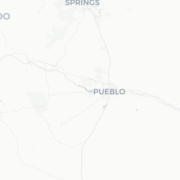
The nearest commercial airports are Pueblo Memorial Airport (roughly 100 miles west) and Colorado Springs Airport (roughly 160 miles northwest). There is no scheduled commercial air service to Lamar Municipal Airport. Travelers will need a rental car from either larger airport.
Getting Around
A personal vehicle is essentially required for getting around Lamar and the surrounding region. The city itself is compact and walkable in its downtown core, but reaching natural areas, Comanche National Grassland, or rural sites requires driving.
Road conditions on gravel and dirt roads leading into the grassland can vary significantly with weather — a high-clearance vehicle is recommended for some back-country routes. Verify road conditions locally or with the US Forest Service Comanche/Cimarron National Grasslands office before heading out.
Where to Stay
Lamar has a modest selection of chain motels and independently owned lodging concentrated near the US Highway 50 corridor. Options tend to be budget to mid-range in price. Travelers visiting during peak events such as Cattlemen's Days should book well in advance, as limited room inventory can fill quickly.
There are also camping options within Comanche National Grassland for those seeking a more immersive experience. Verify campsite availability, facilities, and any permit requirements with the US Forest Service before arrival. Primitive camping rules apply in many areas of the grassland.
Things to See & Do
Birding
Lamar is recognized as one of the premier bird-watching locations in Colorado. The Arkansas River corridor, adjacent wetlands, and surrounding grasslands attract an exceptional variety of species. The area is particularly noted for wintering raptors — including ferruginous hawks, rough-legged hawks, and occasional golden and bald eagles — and for spring and fall songbird migration. The Lamar Community College area and the city's parks along the river are accessible starting points.
Comanche National Grassland
Managed by the US Forest Service, this vast expanse of short-grass prairie begins south of Lamar. It contains the Picket Wire Canyonlands, home to the longest known dinosaur tracksite in North America, as well as ancient Native American rock art and significant wildlife habitat including prairie dogs, pronghorn, and lesser prairie-chickens. Access details and permit requirements (if any) should be confirmed with the local US Forest Service office.
Big Timbers Museum
This local history museum documents the culture and history of Prowers County and the Arkansas Valley, covering the Santa Fe Trail era, Native American history, early settlement, and ranching heritage. Verify current hours and admission before visiting.
Lamar Cattlemen's Days
Typically held in July, this long-running rodeo and community celebration is one of the region's major annual events. Check the city's official calendar for current dates and programming.
Santa Fe Trail History
Lamar sits along the historic Mountain Branch of the Santa Fe Trail. Historical markers and interpretive signage in the region help travelers trace this important 19th-century trade route.
Food & Drink
Lamar's dining scene is practical rather than culinary. The city has a range of familiar fast-food chains along the highway corridors, as well as several locally owned diners and Mexican restaurants that reflect the regional ranching and agricultural culture. Mexican food, steaks, and American diner fare are the most common offerings.
Grocery options exist in town for travelers who prefer to self-cater, which is a reasonable approach if you're planning extended time in the grasslands. Note that alcohol purchasing rules may vary — Colorado allows alcohol sales in grocery and liquor stores, but hours and availability should be confirmed locally.
Travelers with specific dietary requirements (vegan, gluten-free, etc.) should plan accordingly, as specialty options are limited in a city this size.
Practical Information
Emergency Services: In the US, dial 911 for police, fire, or medical emergencies.
Medical: Prowers Medical Center is Lamar's local hospital. For serious emergencies, larger medical facilities are in Pueblo or Colorado Springs.
Banking & ATMs: Basic banking services and ATMs are available in town. Confirm hours locally.
Fuel: Fill your tank before heading into the grasslands or rural areas south of Lamar, where no services exist for long stretches.
US Forest Service — Comanche/Cimarron National Grasslands: The local ranger district office can provide current road conditions, maps, and guidance on accessing the grassland's backcountry sites. It is strongly recommended to contact them before visiting Picket Wire Canyonlands or other remote areas.
Safety
Lamar is a small, generally quiet community. Standard urban precautions apply — be aware of your surroundings and secure valuables in your vehicle.
The primary safety considerations in this region are weather and wilderness-related. Southeastern Colorado is prone to severe thunderstorms, lightning, and hail in summer. Tornadoes are a real risk on the High Plains from spring through early summer — familiarize yourself with local warning systems and shelter options.
When visiting Comanche National Grassland, tell someone your plans, carry more water than you think you need (heat and aridity are serious concerns), and be aware that rattlesnakes and other wildlife are present. Cell service is unreliable in the grasslands.