Overview
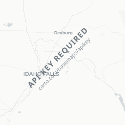
Ririe is a small agricultural community of roughly 600 people situated in eastern Idaho's Snake River Plain, about 20 miles northeast of Idaho Falls. It sits in Bonneville County at an elevation of around 4,800 feet, surrounded by farmland and foothills that rise toward the Caribou-Targhee National Forest.
The town's primary draw for visitors is Ririe Reservoir, a U.S. Army Corps of Engineers impoundment on the Willow Creek that provides boating, fishing, camping, and swimming opportunities within easy reach of the Idaho Falls area. The reservoir was completed in 1976 and remains a local favorite for warm-season recreation.
Ririe itself has very limited visitor infrastructure — no chain hotels, few restaurants — so most travelers treat it as a destination for outdoor recreation rather than an urban stop. Visitors who appreciate quiet, uncrowded natural settings and a genuine rural Idaho atmosphere will find it worthwhile.
Before You Go
Visas
Ririe is in the United States. For visa requirements, check TravelerPulse's Visas section and the official U.S. Customs and Border Protection website.
What to Pack
- Sun protection is essential; eastern Idaho has intense summer sun at elevation
- Layers are advisable year-round; temperatures can drop significantly at night even in summer
- Bring your own supplies — groceries, fuel, and gear should be acquired in Idaho Falls before heading out
- If camping at the reservoir, bring insect repellent, as mosquitoes can be active near the water in early summer
Seasonal Notes
- Summer (June–August): Peak season for the reservoir; warm days, busy weekends
- Spring/Fall: Quieter, good for fishing; afternoon thunderstorms possible in spring
- Winter: The reservoir area sees cold temperatures and snow; most recreation facilities have reduced or no services
Getting There
The nearest commercial airport is Idaho Falls Regional Airport (IDA), approximately 20–25 miles southwest of Ririe. From there, visitors typically rent a car, as no scheduled public transit connects the airport to Ririe.
By road, Ririe is reached via Idaho State Highway 26 (Lincoln Highway), which connects it to Idaho Falls to the west. The drive from Idaho Falls is straightforward and takes roughly 25–30 minutes depending on traffic.
There is no intercity bus or passenger rail service to Ririe. A personal vehicle or rental car is the only practical way to reach and explore the area.
Getting Around
A personal vehicle is essential in and around Ririe. There is no local public transportation. The town itself is small enough to walk, but the reservoir, campgrounds, and surrounding recreation areas require a car.
Roads to the reservoir are generally paved and accessible to standard vehicles. Some secondary forest roads in the surrounding hills may require high-clearance vehicles, particularly in wet conditions — verify road conditions locally before venturing onto unpaved routes.
Things to See & Do
Ririe Reservoir
The reservoir is the primary reason most visitors come to the area. Activities include boating, water skiing, fishing (bass, perch, and trout are commonly caught — verify current regulations and licensing requirements with Idaho Fish & Game), and swimming. The U.S. Army Corps of Engineers manages the site and operates recreation areas with boat ramps and picnic facilities. Verify current fees and facility hours directly with the Corps or on-site.
Camping
Campgrounds at the reservoir provide a base for multi-day visits. Availability and reservation processes should be confirmed via the relevant federal recreation booking system (Recreation.gov is commonly used for Corps of Engineers sites in Idaho — verify applicability).
Scenic Drives and Wildlife Viewing
The countryside around Ririe offers pleasant drives through agricultural land and foothills. Mule deer, raptors, and migratory waterfowl are commonly spotted in the area, particularly near the reservoir and surrounding wetlands.
Proximity to Eastern Idaho Attractions
Ririe's location makes it a reasonable side trip when visiting the broader eastern Idaho region, including the Snake River and Caribou-Targhee National Forest access points.
Food & Drink
Ririe has very limited dining options; visitors should not assume restaurants will be open or available. Stock up on food and beverages in Idaho Falls before arriving, particularly if planning to camp or spend a full day at the reservoir.
Idaho Falls, 20–25 miles away, has a full range of dining options including local restaurants, grocery stores, and fast food — it is the practical hub for all provisioning.
Practical Information
Emergency Services
For emergencies, dial 911. Bonneville County Sheriff's Office serves the Ririe area. Cell coverage may be limited in some areas around the reservoir and in surrounding hills — verify your carrier's coverage before heading out.
Medical
The nearest hospitals and urgent care facilities are in Idaho Falls. There is no hospital in Ririe.
Fuel and Supplies
Fuel availability in Ririe is limited. Fill your tank in Idaho Falls to avoid uncertainty.
Fishing and Boating Licenses
Idaho state fishing licenses and any required boating registration must be obtained in advance. Check Idaho Fish & Game's official website for current regulations, fees, and licensing requirements.
Connectivity
Wi-Fi and reliable cellular service are not guaranteed in Ririe or at the reservoir. Download offline maps before traveling.
Safety
Ririe is a quiet rural community with no particular safety concerns beyond those standard to outdoor recreation. Water safety is the primary consideration at the reservoir — life jackets are required on watercraft and strongly recommended for all water activities.
Weather can change quickly in eastern Idaho, especially in spring and fall. Afternoon thunderstorms are possible in summer. Check forecasts before outdoor activities and be prepared to seek shelter.
Wildlife encounters (rattlesnakes, though not common, are present in the region's drier areas) are possible in surrounding countryside. Stay on established paths where possible and watch where you step.