Overview
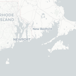
Southborough is a small, historically grounded town of roughly 9,700 residents situated in Worcester County, in the MetroWest region of Massachusetts. It sits about 30 miles west of Boston and 10 miles east of Worcester, placing it squarely in the commuter belt while retaining a distinctly rural, village-scale feel.
The town center clusters around a traditional New England common, with white-steeple churches, modest historic commercial buildings, and tree-lined streets that change dramatically with the seasons. The Sudbury River and several reservoirs — part of the Metropolitan District Commission water supply system — weave through the landscape, limiting development and preserving open space.
Southborough is not a conventional tourist destination. Visitors typically arrive for day hiking, cycling, heritage interest, or to see Fay School, one of the oldest junior boarding schools in the United States. Travelers passing through on the Mass Pike (I-90) corridor or exploring the broader MetroWest area will find it a pleasant, unhurried stop.
Before You Go
Visas and Entry
Southborough is in the United States. For visa and entry requirements, check TravelerPulse's Visas section and the U.S. Customs and Border Protection official website.
What to Expect
This is a quiet residential and small-business town. There is no significant tourism infrastructure — no large hotels within the town limits, no visitor center, and limited evening dining options. Plan activities and meals in advance, or be prepared to drive to nearby Westborough, Marlborough, or Framingham for more choice.
Practical Preparation
- A car is strongly recommended; public transit options are limited.
- Cell coverage is generally reliable, but some conservation land trails have gaps.
- The town has no dedicated tourism office; the town's official municipal website is the best starting point for local information. Verify all hours and access details locally before visiting.
Getting There
By Car
Southborough is directly accessible via Interstate 90 (Massachusetts Turnpike) at Exit 91 (formerly Exit 11). Route 9 also passes through the southern edge of town, connecting it to Framingham to the east and Westborough to the west. Most visitors arrive by car.
By Train
The MBTA Commuter Rail Framingham/Worcester Line serves Southborough with a local station. Trains run between Boston's South Station and Worcester, with a stop in Southborough. Schedules and fares vary; verify current timetables on the MBTA website (mbta.com) before travel. The station area has limited walkable amenities, so onward transportation within town still typically requires a car or rideshare.
By Air
The nearest major airport is Boston Logan International (BOS), approximately 35–40 miles to the east. Worcester Regional Airport (ORH) is closer at roughly 15 miles, though it offers limited commercial service. Verify routes and connections before booking.
Getting Around
A personal vehicle or rideshare is the practical way to get around Southborough. The town has no local bus system and distances between points of interest — particularly conservation areas, the town center, and the train station — make walking between them unrealistic for most visitors.
Rideshare apps (Uber, Lyft) operate in the area but availability can be inconsistent, especially during off-peak hours. Cycling is possible on quieter back roads and some trail connections, though dedicated cycling infrastructure is minimal. If you plan to explore multiple conservation areas in one day, a car will save considerable time.
Things to See & Do
Conservation Land and Trails
Southborough has a meaningful network of conservation land managed by the town and the Southborough Open Land Foundation (SOLF). Trails traverse woodland, wetland edges, and the Sudbury River corridor. Breakneck Hill Conservation Land, off Breakneck Hill Road, is a locally popular walk with open meadow and woodland paths and views toward the Sudbury River valley. Trails are generally unimproved; sturdy footwear is advisable.
Sudbury Reservoir Area
The reservoirs in and around Southborough are part of the metropolitan water supply and most water-surface activities are restricted, but the surrounding protected land offers quiet walking. Check current access rules with the DCR (Massachusetts Department of Conservation and Recreation) before visiting, as regulations can change.
Fay School
Founded in 1866, Fay School is recognized as one of the oldest junior boarding schools in the country and a historic landmark in the town center. The campus itself is private; visitors should not expect open public access, but the exterior and surrounding streetscape are worth a brief look for those interested in New England educational heritage.
Town Common and Village Center
The historic town common area provides a prototypical New England scene, particularly photogenic in autumn. St. Mark's School, another well-regarded preparatory school, is situated nearby in Southborough and contributes to the town's quiet academic character.
Cycling and Road Touring
The roads around Southborough — particularly those running through conservation corridors — attract recreational cyclists. Traffic is generally light on secondary roads. Verify conditions locally and carry a printed or downloaded map, as signage is sparse.
Food & Drink
Southborough's dining scene is small and locally oriented, not a culinary destination. The town center and Route 9 corridor have a modest selection of casual restaurants, pizza spots, and coffee shops. Options expand significantly in neighboring Westborough and Framingham, both within a 10–15 minute drive.
For groceries and everyday supplies, there are options along the Route 9 commercial corridor. Farmers markets and farm stands operate seasonally in the MetroWest region — check local listings for current schedules and locations, as these change year to year.
If you have specific dietary requirements or are planning a dinner out, research and reserve in advance or plan to travel to a larger nearby town. Do not rely on finding a wide variety of options within Southborough itself on a given evening.
Practical Information
Emergency Services
For any emergency in the United States, dial 911. Southborough has its own police, fire, and emergency medical services. The nearest hospital-level care is at UMass Memorial Medical Center in Worcester or Framingham-area facilities; verify the closest appropriate facility before you travel, particularly if you have medical needs.
Connectivity
Cellular service from major US carriers is generally reliable in the town center and along main roads. Some wooded conservation areas may have reduced signal. Wi-Fi is available at the public library; verify hours locally.
Money
ATMs are available at banks along the Route 9 corridor. Most businesses accept major credit and debit cards. Carry some cash for any small local vendors or trail parking fee stations.
Accessibility
Conservation trails are largely natural-surface and unpaved, which limits wheelchair and mobility-device accessibility. The town center and commercial areas along Route 9 have standard American ADA-compliant infrastructure. Verify specific access needs directly with any venue.
Safety
Southborough is a low-crime suburban and rural community. Standard precautions appropriate to small-town New England apply: lock your car, do not leave valuables visible, and let someone know your plans if heading into conservation land alone.
Wildlife is present in wooded areas — white-tailed deer are common, and encounters with coyotes or the occasional black bear are possible in conservation land. Keep distance from wildlife and follow Massachusetts guidelines on wildlife encounters. Tick awareness is important from spring through late autumn; check for ticks after any time in grass or woodland.