Translate
Overview
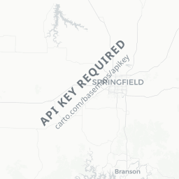
Rogersville is a small city of roughly 3,400 residents situated in Webster County in southwest Missouri, about 15 miles east of Springfield along US Route 60. Nestled in the Ozarks foothills, it sits in a landscape of rolling hills, cedar glades, and the upper James River watershed.
The town has the character of a close-knit rural community — quiet streets, a modest commercial center, and a surrounding countryside that appeals to those who want to step away from urban pace. Most travelers who stop here are passing through the Springfield–Branson corridor or are drawn by the outdoor recreation available in the broader region.
Because Rogersville is small, visitors should think of it as a peaceful home base rather than a destination packed with attractions. The city's real draw is its authentic Ozarks setting and easy access to the natural and cultural resources of southwest Missouri.
Getting There
By Air
The nearest commercial airport is Springfield-Branson National Airport (SGF), approximately 15–20 miles west of Rogersville. It serves several major US hubs via regional carriers. Verify current routes and schedules on the airport's official site before booking.
By Car
US Route 60 runs directly through Rogersville, making it straightforward to reach by car from Springfield to the west or Cabool to the east. Interstate 44 is accessible via Springfield, connecting the area to St. Louis and Oklahoma City. Driving is by far the most practical way to arrive.
By Bus
Long-distance bus services (such as Greyhound) serve Springfield; verify locally whether any regional connections extend to Rogersville, as schedules change. A car or rideshare from Springfield is the most reliable option.
Getting Around
A personal vehicle is essentially required for getting around Rogersville and exploring the surrounding area. The town itself is small enough to walk in its central portions, but reaching nearby recreation areas, lakes, or Springfield requires driving.
Rideshare apps (Uber, Lyft) may have limited availability in a community this size — verify locally before relying on them. Car rental options are available at Springfield-Branson National Airport if you are flying in.
Where to Stay
Rogersville itself has limited dedicated lodging. Travelers will find a broader selection of hotels, motels, and chain accommodations in Springfield, which is close enough to use as a base while visiting the area.
Short-term rental platforms (Airbnb, Vrbo) sometimes list rural Ozarks properties in and around Webster County — worth checking if you prefer a more secluded, countryside stay. Verify listings carefully, including exact location and distance to local amenities, before booking.
If visiting for outdoor recreation along the James River corridor, some campgrounds and primitive sites may be available in the broader region — confirm current availability and permits through Missouri State Parks or the Army Corps of Engineers' official resources.
Things to See & Do
Outdoor Recreation
The James River and its tributaries run through the region, offering opportunities for fishing, kayaking, and wildlife observation. The Ozarks landscape surrounding Rogersville is suitable for hiking and birdwatching, particularly in spring and fall migration seasons.
Nearby State and Regional Parks
Mark Twain National Forest has units accessible within a reasonable drive, and the greater Springfield metro has parks and greenways worth exploring. Verify current access and trail conditions locally or through Missouri State Parks' official website.
Day Trips
Rogersville's location on US 60 makes it a logical midpoint for day trips to Springfield (arts, culture, Bass Pro Shops headquarters) or Branson (live entertainment, Table Rock Lake) — both within roughly 30–45 minutes by car.
Local Community Events
Small Missouri towns often host seasonal festivals, farmers markets, and community gatherings. Check with the Webster County or Rogersville city offices for current local event schedules, as these vary year to year.
Food & Drink
Rogersville has a modest selection of local diners, convenience stores, and small eateries typical of a rural Missouri town. Specific establishments open and close; verify current options through Google Maps or by asking locally upon arrival.
For a wider range of dining — from casual American to international cuisines — Springfield is the practical answer, with a well-developed restaurant scene about 15–20 miles west. Branson also has numerous dining options if you are heading that direction.
Grocery and supply runs for self-catering travelers are most reliably done in Springfield, though Rogersville and nearby communities along US 60 have basic grocery and convenience options.
Practical Information
Connectivity
Cell coverage in Rogersville is generally reasonable given its proximity to Springfield, though rural areas just outside town may have gaps. Download offline maps before exploring backcountry routes.
Medical and Emergency Services
For non-emergency medical needs, facilities in Springfield (including CoxHealth and Mercy hospital systems) are the most comprehensive option in the region. In a genuine emergency, dial 911.
Visas
Rogersville is a US city. For visa and entry requirements, visit TravelerPulse's Visas section and consult the US Department of State or the official immigration authority of your home country for current, authoritative guidance.
Tipping
Standard US tipping practices apply: 15–20% at sit-down restaurants is customary.
Safety
Rogersville is a quiet, low-crime rural community. Standard travel common sense applies: keep valuables out of sight in parked vehicles, be aware of your surroundings in unfamiliar rural areas after dark, and let someone know your itinerary if heading into remote outdoor areas.
Ozarks weather can change quickly, particularly in spring (tornado season) and winter (ice storms). Monitor forecasts via the National Weather Service (weather.gov) and have a plan if severe weather develops. Flash flooding can affect low-lying roads near rivers and streams — do not drive through flooded roadways.