Overview
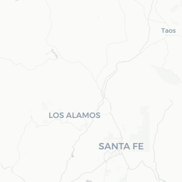
Carnuel is a small, unincorporated community of roughly 1,200 residents situated at the western mouth of Tijeras Canyon, where Interstate 40 cuts through the Sandia Mountains on Albuquerque's eastern fringe. The area sits at approximately 5,500 feet in elevation, giving it a high-desert character with scrubby piñon-juniper woodland and dramatic rocky terrain.
The community has a long human history — the name Carnuel derives from a Spanish colonial-era land grant, and the canyon corridor was used by Indigenous peoples long before European settlement. Today Carnuel functions largely as a quiet residential area rather than a tourist destination in its own right, but its position at the edge of the Cibola National Forest and the Sandia Mountains makes it a useful reference point for travelers exploring the greater Albuquerque region.
Visitors passing through on I-40 will notice the canyon walls closing in dramatically around the community — a striking landscape introduction to the mountain terrain that separates the Rio Grande valley from the East Mountains. For travelers interested in canyon scenery, nearby hiking, or the ecological transition zone between desert and mountain forest, a brief stop or detour can be worthwhile.
Before You Go
Carnuel has no dedicated visitor infrastructure — no tourism office, no staffed attractions, and very limited commercial services. Travelers should treat it as a pass-through point or a quiet residential community rather than a self-contained destination.
Visas
For entry requirements into the United States, check TravelerPulse's Visas section and the official U.S. Customs and Border Protection website for current rules applicable to your nationality.
What to bring
- Water and snacks: services within Carnuel itself are extremely limited; stock up in Albuquerque or at the nearby Tijeras village
- Sun protection: the high-desert sun is intense even in cooler months
- Layers: canyon terrain creates temperature swings between morning and afternoon, especially in spring and fall
- A full tank of fuel before entering the canyon if continuing east on I-40
Getting There
Carnuel sits directly on Interstate 40 approximately 10–12 miles east of downtown Albuquerque, making it easily accessible by car. The Tijeras Canyon exit off I-40 is the primary access point. The drive from central Albuquerque typically takes 15–20 minutes under normal traffic conditions.
By air: Albuquerque International Sunport (ABQ) is the nearest commercial airport, located roughly 20 miles west of Carnuel. Car rental is the most practical option for reaching the community.
By public transit: ABQ Ride and the Rio Metro regional transit system serve the greater Albuquerque area, but direct public transit to Carnuel is not established. Verify current route coverage on the ABQ Ride or Rio Metro websites before traveling without a car.
By road from the east: Travelers coming from Santa Rosa or Amarillo on I-40 will pass through Tijeras Canyon and through Carnuel's immediate vicinity before reaching Albuquerque — it is naturally on-route.
Getting Around
A personal vehicle is essentially required for getting around Carnuel and the surrounding canyon area. The community is linear in layout, running along the canyon corridor, and there are no local transit options or ride-share hubs within the community itself.
Ride-sharing services such as Uber and Lyft operate in the Albuquerque metro area and may reach Carnuel, but availability can be limited and wait times longer than in central Albuquerque. Verify availability before relying on this option.
Cyclists should be cautious: Route 66 (Central Avenue) and the canyon roads carry vehicle traffic and have limited dedicated cycling infrastructure in this stretch.
Things to See & Do
Carnuel's main draw is its natural setting at the confluence of high desert and mountain terrain. Activities are largely outdoor-oriented and self-directed.
Tijeras Canyon Scenery
The drive through the canyon on I-40 or the parallel Historic Route 66 offers striking views of layered rock formations and the abrupt rise of the Sandia Mountains. The old Route 66 alignment through the canyon is slower and more scenic than the interstate.
Access to Cibola National Forest
The Sandia Ranger District of Cibola National Forest borders the area. Hikers and mountain bikers have access to trail networks in the Sandias, with trailheads accessible from nearby Tijeras and the forest roads east of the community. Conditions and access points vary — verify current trail status with the Sandia Ranger District before heading out.
Wildlife Observation
The canyon corridor is a recognized transition zone where Chihuahuan Desert species meet montane forest species. Mule deer, coyotes, various raptors, and a range of songbirds are commonly observed. Early morning visits yield the most wildlife activity.
Historic Route 66 Corridor
For road history enthusiasts, the old alignment of Route 66 through Tijeras Canyon is a tangible piece of mid-20th-century American travel culture. The route predates the interstate and follows the canyon more closely.
Food & Drink
Carnuel itself has no established restaurant or café scene to speak of. Travelers should plan meals before arriving or continue to the neighboring village of Tijeras (a few miles east) or head back into Albuquerque's East Side.
Albuquerque's Nob Hill neighborhood and the Central Avenue corridor along old Route 66 offer a wide range of dining options representing New Mexican cuisine, including green and red chile dishes, sopapillas, and carne adovada — staples of the state's food culture. Verify which restaurants are currently operating, as the dining scene changes regularly.
Practical Information
Emergency Services
For any emergency in the United States, dial 911. The community falls under Bernalillo County jurisdiction for law enforcement and emergency services. The nearest hospitals with emergency departments are in Albuquerque; verify the closest facility to your location on arrival.
Connectivity
Cell service is generally available along the I-40 corridor through Tijeras Canyon, though signal can drop in pockets of the canyon. Do not rely solely on GPS navigation without a downloaded offline map.
Altitude
At roughly 5,500 feet, visitors coming from low-elevation areas may notice mild altitude effects — headaches or shortness of breath. Staying hydrated helps. Full acclimatization typically takes a day or two.
Weather
Summer (June–August) afternoons frequently bring thunderstorms, which can make canyon roads slippery and cause flash flooding in arroyos. Check weather forecasts and heed any flash flood advisories. Winters can bring snow and icy road conditions in the canyon; I-40 through Tijeras Canyon occasionally closes temporarily during severe storms. Check NMDOT road conditions before winter travel.
Safety
Carnuel is a quiet residential community and generally presents no unusual safety concerns for travelers. Standard travel awareness applies: secure valuables in your vehicle, especially at trailhead parking areas where car break-ins have been reported throughout the Sandia Mountains recreation corridor.
Flash flooding is the most significant natural hazard in the canyon, particularly during the July–September monsoon season. Never attempt to drive through flooded washes — the "turn around, don't drown" guideline applies strictly in this terrain.
If hiking in the adjacent national forest, inform someone of your plans, carry sufficient water (at least one liter per hour of activity in warm weather), and be aware that cell coverage can be unreliable on trails above the canyon.