Overview
Mesquite is a small, quiet agricultural community in Doña Ana County, situated in the Mesilla Valley along the Rio Grande in southern New Mexico. With a population of just over 1,000 people, it is not a conventional tourist destination but rather a rural village that reflects the deep-rooted farming and Hispanic heritage of the region.
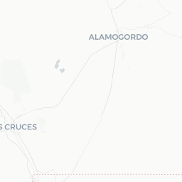
The surrounding landscape is dominated by pecan orchards and chile pepper fields — crops that define the identity and economy of the broader Mesilla Valley. The area sits between the larger communities of Las Cruces to the north and El Paso, Texas, to the south, making Mesquite a natural stopping point along the Rio Grande corridor.
Travelers who find their way here are typically passing through on a road trip along New Mexico Route 28, a scenic byway that winds through a string of historic farming villages. Mesquite offers a genuine, unhurried glimpse into the agricultural life of the American Southwest.
Before You Go
Mesquite has very limited visitor infrastructure — there are no major hotels, visitor centers, or tourist attractions within the village itself. Plan your visit as part of a broader itinerary centered on Las Cruces or the Mesilla Valley area.
Visas: Entry requirements depend on your nationality. For guidance, visit TravelerPulse's Visas section and check the official US Customs and Border Protection website for current information.
What to bring:
- Water and snacks, as shops are minimal in the village
- Sun protection — southern New Mexico sun is intense for much of the year
- Cash, as small local vendors may not accept cards
- A road map or downloaded offline maps, as cell coverage can be patchy in rural areas
Summer (June–August) brings intense heat with temperatures regularly exceeding 38 °C (100 °F). Spring and autumn offer the most comfortable conditions for exploring the valley by car or bicycle.
Getting There
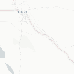
The nearest major airport is El Paso International Airport (ELP) in El Paso, Texas, approximately 50–60 km (30–40 miles) to the south. This is the most practical air gateway for visiting the southern Mesilla Valley. Las Cruces is served by a smaller regional airport; verify current commercial service before booking.
Mesquite is accessible by car via New Mexico Route 28, a scenic two-lane road that runs the length of the Mesilla Valley. From Las Cruces, the drive is roughly 20–25 minutes heading south. From El Paso, allow approximately 45–60 minutes via I-10 north and then NM-28.
There is no scheduled public bus or rail service directly to Mesquite. Visitors without a private vehicle should base themselves in Las Cruces and arrange a rental car or rideshare for day trips into the valley.
Getting Around
A private vehicle is essentially required to get around Mesquite and the surrounding Mesilla Valley. The village itself is small enough to walk through in under an hour, but reaching nearby orchards, villages, and points of interest requires driving.
New Mexico Route 28 is the main artery for exploring the valley. The road is flat and well-maintained, making it suitable for cycling for those comfortable riding alongside rural traffic. Distances between valley villages are short — typically 5–15 km (3–10 miles).
Rideshare apps such as Uber and Lyft may have limited availability in this rural area. Verify coverage before relying on them, and consider arranging transportation from Las Cruces in advance.
Things to See & Do
Mesquite's appeal lies in its pastoral landscape rather than organized attractions. The primary draw is the scenic drive along NM-28 through the pecan and chile orchards of the Mesilla Valley, particularly beautiful in autumn when pecan harvests are underway.
Scenic Driving and the NM-28 Corridor
The stretch of NM-28 between Mesquite and the historic village of La Mesilla to the north is one of the most picturesque rural drives in southern New Mexico. Roadside farm stands appear seasonally, selling locally grown pecans, red and green chiles, and seasonal produce. Availability and hours vary — verify locally.
Rio Grande Access
The Rio Grande flows near the village, and the broader valley has rural paths and informal access points for birdwatching and quiet nature walks. The river corridor attracts migratory birds, particularly in spring and autumn.
Day Trips
Mesquite is an ideal base point for visiting the historic Plaza of Old Mesilla, White Sands National Park, and the Organ Mountains–Desert Peaks National Monument — all within a reasonable driving distance.
Food & Drink
Dining options within Mesquite village are very limited. Travelers should not rely on finding restaurants or cafés in the village itself.
The broader Mesilla Valley and nearby Las Cruces offer a rich dining scene centered on New Mexican cuisine — green and red chile sauces, enchiladas, tamales, and chile rellenos are regional staples. Old Mesilla (a short drive north) has several established restaurants serving traditional New Mexican and Mexican border cuisine.
Farm stands along NM-28 are a highlight for food-minded travelers. Locally grown pecans and Hatch-style chiles (the region is at the southern end of the renowned New Mexico chile belt) can be purchased fresh or roasted in season. Verify locally for current stand locations and seasonal availability.
Practical Information
Emergency services: Dial 911 for all emergencies in the United States. The nearest hospital and full emergency services are in Las Cruces. Verify the location of the nearest urgent care facility before your visit.
Connectivity: Cell phone coverage can be inconsistent in rural Doña Ana County. Download offline maps before arriving.
Fuel: Fill up your tank in Las Cruces or Anthony before driving the NM-28 rural corridor, as gas stations are sparse.
Climate: Summers are hot and dry; bring ample water. Afternoon monsoon thunderstorms are common July through September. Winters are mild by day but can drop below freezing at night.
Language: English is the primary language for official purposes; Spanish is widely spoken in daily life throughout the Mesilla Valley and is useful when interacting with local farm communities.
Safety
Mesquite and the surrounding Mesilla Valley are generally calm and low-risk for travelers. Standard rural travel precautions apply.
Note that the US–Mexico border is approximately 50 km (30 miles) to the south. You may encounter US Border Patrol checkpoints on major roads in the region. Carry valid identification at all times. Travelers with non-US citizenship should carry their passport and any relevant travel documents.
Driving at dusk or dawn in agricultural areas carries a risk of wildlife or livestock on the road. Stay alert, particularly on rural two-lane roads like NM-28.