Translate
Overview
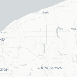
Ashtabula is a small lakeside city in the far northeastern corner of Ohio, sitting on the southern shore of Lake Erie roughly 60 miles northeast of Cleveland. With a population of around 18,000, it has the feel of a working harbor town that has quietly developed a tourism identity built around its natural setting and regional heritage.
The city is perhaps best known as the seat of Ashtabula County, which contains more covered bridges than any other county in Ohio — a draw that anchors an annual festival each October. The downtown harbor district, known locally as Bridge Street, has undergone incremental revitalization and offers a cluster of restaurants, shops, and waterfront access.
Ashtabula also sits at the eastern edge of Ohio's Lake Erie wine country, a grape-growing corridor that stretches along the lakeshore. The moderating influence of the lake creates a microclimate suitable for viticulture, and several wineries and vineyards operate within easy driving distance of the city. Visitors who enjoy slow-travel, rural scenery, and unpretentious Rust Belt character tend to find Ashtabula rewarding.
Before You Go
Visas and Entry
Ashtabula is a domestic US destination. International visitors should check TravelerPulse's Visas section and consult the US Citizenship and Immigration Services (USCIS) website or their nearest US embassy for current entry requirements.
What to Pack
- Lake Erie weather changes quickly; bring a waterproof layer even in summer
- Comfortable walking shoes for harbor strolls and covered bridge sites, some of which involve unpaved paths
- A car is essentially required — public transportation within the city is limited and connections to outlying bridges and wineries are not practical without a vehicle
Seasonal Considerations
Winters in Ashtabula are notable for lake-effect snow, which can be heavy and unpredictable. Summer is generally mild and humid. The October Covered Bridge Festival is the city's largest annual event and draws significant visitors to the county — book accommodation well in advance if traveling during that period.
Getting There
By Car
Ashtabula sits directly on US Route 20 and is accessible from Interstate 90 (exit 223 for the city center). From Cleveland, the drive is approximately one hour northeast via I-90. From Erie, Pennsylvania, the drive is roughly 45 minutes southwest on I-90.
By Air
The nearest major airport is Cleveland Hopkins International Airport (CLE), located about 60 miles to the west. Erie International Airport (ERI) in Pennsylvania is a smaller option roughly 45 miles to the northeast. Car rental at either airport is the practical onward option.
By Bus
Greyhound and regional bus services connect Ashtabula to larger Ohio cities, but schedules are limited. Verify current routes and schedules directly with carriers before travel.
By Train
Amtrak's Lake Shore Limited route stops at the Conneaut station, approximately 12 miles east of Ashtabula, on its Chicago–New York/Boston corridor. Confirm current stops and schedules at amtrak.com, as service details can change.
Getting Around
A personal vehicle is the most practical way to explore Ashtabula and the surrounding county. The covered bridges, wineries, and many natural areas are spread across a rural landscape not served by regular transit. The city's compact harbor district is walkable once you have parked.
Rideshare availability (Uber, Lyft) within the city exists but can be inconsistent, particularly outside daytime hours. Verify availability through the apps before relying on them. Bicycle use is feasible for the immediate harbor area in good weather, but road shoulders outside town are narrow.
Things to See & Do
Covered Bridges
Ashtabula County has approximately 19 covered bridges still standing, making a self-guided driving tour one of the county's signature experiences. The Ashtabula County Covered Bridge Festival, held each October, is organized around this heritage. A county map of bridge locations is available from the Ashtabula County Convention & Visitors Bureau — verify current access conditions locally, as some rural roads may be seasonally affected.
Harbor District (Bridge Street)
The Bridge Street district sits where Ashtabula Creek meets Lake Erie. It offers waterfront views, a marina, and a concentration of locally owned restaurants and small shops. The area has a relaxed, unhurried character well-suited to an afternoon on foot.
Lake Erie Shoreline
Walnut Beach Park provides public beach access on Lake Erie. Water quality and swimming advisories vary by season — check with local authorities or the Ohio EPA before swimming. The lakefront is popular for fishing and sunset watching regardless of season.
Lake Erie Wine Country
The wine region stretching through Ashtabula County and into neighboring Lake and Geauga counties includes several family-operated wineries open to visitors. Varietals adapted to the cool lake climate — including Riesling, Pinot Gris, and various red blends — are common. Verify individual winery hours before visiting, as many operate seasonally.
Hubbard House Underground Railroad Museum
This historic site in Ashtabula is associated with the Underground Railroad and is listed on the National Register of Historic Places. Opening hours and admission details should be confirmed directly with the museum before your visit.
Food & Drink
Dining in Ashtabula is concentrated in and around the Bridge Street harbor district. Seafood, particularly Lake Erie perch — a regional staple across the Great Lakes — appears on menus at local establishments. The area also reflects broader Northeast Ohio comfort-food traditions.
The surrounding wine country means that local wineries often feature tasting rooms with light food pairings. A number of small, independently owned restaurants operate in the harbor area; the selection is modest but reflects genuine local character rather than chain dining.
For groceries and everyday provisions, standard supermarkets are present within the city. Visitors planning winery tours should arrange a designated driver or pace themselves, as distances between establishments require driving.
Practical Information
Emergency Services
For all emergencies in the United States, dial 911.
Medical
Ashtabula County Medical Center provides hospital services. Verify address and hours locally or via the facility's official website.
Money
ATMs are available at local banks and some commercial establishments. Most businesses accept major credit cards; carry some cash for smaller vendors at markets or festivals.
Internet and Connectivity
Mobile coverage (major US carriers) is generally reliable in the city. Rural areas of the county, particularly back roads near covered bridges, may have weaker signal.
Useful Contacts
- Ashtabula County Convention & Visitors Bureau: The primary local tourism resource; verify contact details and website at the time of travel for current event and attraction information.
Safety
Ashtabula is a small Rust Belt city with typical considerations for a community of its size and economic profile. The harbor district, which sees the most visitor traffic, is generally calm during daytime and evening hours.
Exercise standard urban awareness — be mindful of your surroundings, particularly in unfamiliar residential areas after dark. Lake Erie weather can change rapidly; if boating or engaging in water activities, check forecasts and heed any small-craft advisories issued by the National Weather Service. Lake-effect snow in winter can make driving conditions hazardous with little warning.