Overview
Grants Pass is a small city of roughly 37,000 people in the Rogue Valley of southwestern Oregon, situated along the Rogue River at an elevation of about 950 feet. It serves as the Josephine County seat and has historically been a working-class timber and agricultural town, though its economy has diversified over the decades. The city's modest downtown retains a genuine, unhurried character.
The Rogue River is the central feature that draws visitors here. It carves through rugged canyon terrain and supports a robust outfitter industry for whitewater rafting, fishing, and jet boat tours. The surrounding Siskiyou and Klamath mountain ranges provide a dramatic backdrop and access to hiking, wildlife, and wild rivers designated under the National Wild and Scenic Rivers Act.
Grants Pass is not a polished resort destination — it is a practical base for outdoor recreation. Visitors come for the river, the adjacent wilderness, and the relatively easy access to larger natural attractions such as the Oregon Caves National Monument and the Kalmiopsis Wilderness. The city's farmers market and small arts community add modest cultural interest without dominating the experience.
Before You Go
Visas and Entry
Grants Pass is located in the United States. Entry requirements vary by nationality. For accurate, current visa information, check the TravelerPulse Visas section and the U.S. Department of State's official website or your nearest U.S. embassy or consulate.
Climate
The Rogue Valley has a Mediterranean-influenced climate with hot, dry summers and mild, wet winters. Summer highs regularly reach the upper 80s to low 100s°F (30–38°C), so hydration and sun protection are important, especially on the river. Winter brings fog and rain to the valley floor but is rarely severe. Spring and fall are temperate and often pleasant.
Practical Preparation
- Bring sunscreen, a hat, and plenty of water for any outdoor activity in summer.
- River trips require appropriate footwear; sandals with straps or water shoes are recommended over flip-flops.
- Cell service can be spotty along the Rogue River canyon. Download offline maps before heading out.
- If you plan to fish, Oregon fishing licenses are required and can be purchased through the Oregon Department of Fish and Wildlife (verify current requirements on their official site).
- Wildfire smoke can affect air quality in late summer; check airnow.gov before outdoor plans.
Getting There
By Air
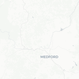
The nearest commercial airport with regular scheduled service is Rogue Valley International–Medford Airport (MFR), located approximately 30 miles east of Grants Pass. It offers connections to several West Coast hubs. Renting a car at MFR is the most practical option for reaching Grants Pass and exploring the surrounding area.
By Road
Grants Pass sits directly on Interstate 5, making it accessible by car from Portland (about 5 hours north) and from the San Francisco Bay Area (roughly 6–7 hours south). US-199 heads southwest toward the California Redwood Coast and passes through Cave Junction near the Oregon Caves.
By Bus
Greyhound and other intercity bus services stop in Grants Pass along the I-5 corridor. Verify current schedules and routes directly with carriers before travel, as service frequency can change.
By Train
There is no Amtrak station in Grants Pass. The closest Amtrak stop on the Coast Starlight route is Klamath Falls to the east, which would still require onward road travel.
Getting Around
A personal vehicle or rental car is effectively essential for visiting Grants Pass and its surroundings. The city itself is walkable in the downtown core, but most natural attractions, river access points, and trailheads require driving, sometimes on winding rural roads.
Rogue Valley Transportation District (RVTD) operates limited local bus service in the Grants Pass area. This is adequate for some in-town errands but is not designed for tourist itineraries. Verify current routes and schedules on the RVTD website.
Rideshare availability (Uber, Lyft) exists in Grants Pass but is less reliable than in larger cities, particularly late at night or in outlying areas. Do not rely on rideshare as a primary transportation strategy for reaching outdoor destinations.
Things to See & Do
Rogue River Recreation
The Rogue River is the dominant attraction. Whitewater rafting trips range from half-day floats on calmer sections to multi-day wilderness expeditions through the Wild and Scenic stretch downstream toward Agness. Several licensed outfitters in and around Grants Pass offer guided trips — book in advance for summer weekends. Jet boat tours departing from the Grants Pass area provide a less strenuous way to experience the river canyon.
Fly fishing and conventional fishing for salmon, steelhead, and trout are serious pursuits on the Rogue. Many visitors plan trips around seasonal runs; confirm run timing and regulations with the Oregon Department of Fish and Wildlife before your trip.
Crater Lake National Park
Grants Pass is one reasonable starting point for a day trip to Crater Lake National Park, Oregon's only national park, located roughly 90 miles northeast. The deep blue lake inside a collapsed volcanic caldera is exceptional. An America the Beautiful annual pass covers entry; verify current fees on the National Park Service website.
Oregon Caves National Monument and Preserve
About 55 miles southwest via US-199 and OR-46, Oregon Caves offers guided cave tours through marble cave formations. Tours are operated by the National Park Service; check nps.gov for current tour availability, hours, and fees.
Downtown and Local Culture
- The Grants Pass Growers' Market (seasonal, verify days and hours locally) is one of the more active farmers markets in southern Oregon.
- Riverside Park along the Rogue in the heart of downtown is a popular gathering spot and a good place to watch the river.
- The Josephine County Historical Society maintains local historical resources for those interested in the region's mining and settlement history.
Hiking
The surrounding Siskiyou National Forest and BLM lands offer hiking opportunities. The Illinois Valley and the trailheads leading toward the Kalmiopsis Wilderness are within reach for experienced hikers. Trail conditions vary; check with the Grants Pass BLM Field Office or the Rogue River–Siskiyou National Forest office before setting out.
Food & Drink
Grants Pass has a modest but genuine local dining scene centered on its downtown. Expect a range of casual American restaurants, Mexican restaurants reflecting the region's agricultural workforce demographics, pizza spots, and a small number of more ambitious farm-to-table style establishments that draw on the Rogue Valley's produce.
The Rogue Valley is a legitimate wine region. Several wineries operate in Josephine and Jackson counties, and local wine is featured at many restaurants. The region grows Tempranillo, Syrah, Viognier, and other varietals suited to its warm, dry summers. Tasting rooms vary in their hours and accessibility — verify before visiting.
Craft beer has a presence in Grants Pass as it does throughout Oregon. A handful of local taprooms serve food alongside house-brewed beer. Specific establishments open and close over time; consult current local listings or Google Maps for what is operating during your visit.
The farmers market (when in season) is a reliable source of locally grown fruit, vegetables, honey, and artisan food products from the Rogue Valley.
Practical Information
Emergency Services
In any emergency in the United States, dial 911 for police, fire, or medical assistance.
Health
Three Rivers Medical Center serves the Grants Pass area as the primary hospital. Verify its current location and services before travel.
Money
ATMs are available at banks and some convenience stores throughout the city. Major credit cards are accepted at most businesses. Some smaller vendors at the farmers market or rural outfitters may prefer cash.
Connectivity
Most hotels and many cafes offer Wi-Fi. Mobile data coverage is generally adequate in the city itself but degrades significantly along river corridors and in the mountains.
Useful Contacts (verify currency before travel)
- Grants Pass & Josephine County Visitor Information Center — check online for current location and hours
- Rogue River–Siskiyou National Forest — fs.usda.gov
- Oregon Department of Fish and Wildlife — dfw.oregon.gov
- National Park Service (Oregon Caves, Crater Lake) — nps.gov
Safety
Grants Pass is a generally safe small city for travelers, though like many communities in southwestern Oregon it has experienced visible homelessness and related social challenges in recent years, particularly in parts of downtown. Exercise normal urban awareness.
The primary safety concerns for most visitors are environmental. River hazards are real: water levels and hazard ratings change with season and precipitation. Always follow the guidance of licensed outfitters and do not attempt unfamiliar rapids without proper experience and equipment. Cold water temperatures, even in summer in some sections, can cause rapid incapacitation if you swim unexpectedly.
Wildfire is a significant seasonal risk in the Rogue Valley. In late summer, monitor local news and Oregon Department of Forestry alerts. Road closures into wilderness areas can occur with little notice during active fire conditions. Smoke can also create serious air quality problems for those with respiratory conditions.