Overview
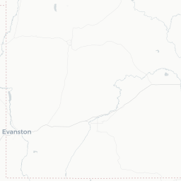
Summit Park is a small residential community of roughly 7,800 people situated in Summit County, Utah, along the eastern slopes of the Wasatch Range at elevations generally above 6,500 feet. It sits just off Interstate 80 between Salt Lake City and Park City, placing it within easy reach of two major urban centers and world-class mountain recreation.
The community is primarily a quiet, mountain-neighborhood setting rather than a tourist destination in its own right. Visitors typically use it as a convenient, less commercialized base for exploring Park City's ski resorts, the Wasatch-Cache National Forest, and the broader Snyderville Basin. The area's character is defined by forested hillsides, canyon terrain, and a resident population that skews toward outdoor enthusiasts.
Because Summit Park lacks a traditional downtown, commercial amenities—restaurants, shops, and hotels—are found in nearby Park City (roughly 10–15 minutes by car) or in the Salt Lake Valley to the west. Travelers should plan accordingly and not expect walkable services within the community itself.
Before You Go
Altitude
Summit Park sits well above 6,000 feet. Visitors arriving from lower elevations—especially those flying into Salt Lake City—should allow a day or two to acclimatize, stay well hydrated, and use sunscreen, as UV exposure increases significantly at altitude.
Seasonal conditions
- Winter (Dec–Mar): Snow accumulation can be heavy. AWD or 4WD vehicles with winter tires are strongly recommended. Check UDOT road conditions (udot.utah.gov) before travel on I-80 and local canyon roads.
- Summer (Jun–Sep): Afternoon thunderstorms are common in the mountains; plan outdoor activities for mornings.
- Spring/Fall: Shoulder seasons bring variable weather; snow can fall as late as May or as early as October.
Visas
Summit Park is in the United States. For entry requirements, check TravelerPulse's Visas section and the official U.S. Customs and Border Protection website (cbp.gov) for the most current information.
Cell and Internet
Coverage can be inconsistent in canyon areas. Download offline maps before arrival.
Getting There
By Air
Salt Lake City International Airport (SLC) is the primary gateway, located approximately 30–35 miles west of Summit Park via I-80. It is a major hub with direct connections to most U.S. cities and numerous international destinations. Verify current flight schedules and fares directly with airlines or booking platforms.
By Car
Driving is the most practical way to reach Summit Park. From SLC airport, take I-80 east through Parleys Canyon to the Summit Park / Jeremy Ranch exits. The drive typically takes 30–40 minutes in normal conditions, though Parleys Canyon can be significantly slower during winter storms or peak ski-season traffic.
By Shuttle or Rideshare
Various ground transportation services operate between SLC airport and the Park City / Snyderville Basin area. Rideshare apps (Uber, Lyft) are available, though availability in Summit Park itself can be limited—verify locally. Several private shuttle companies serve the Park City corridor; check current operators and fares on arrival or via the Utah Office of Tourism.
Getting Around
A personal vehicle is essentially required for getting around Summit Park and the surrounding area. The community has no transit stops within it, and the terrain is hilly with no meaningful pedestrian infrastructure connecting neighborhoods to services.
Regional Transit
Park City Transit operates bus routes in the Snyderville Basin and Park City area. Some routes may serve stops near the I-80 corridor. Check current routes and schedules at parkcity.org or ridethebus.org before your trip, as service levels change seasonally.
Car Rentals
Rental agencies are available at Salt Lake City International Airport. Booking in advance is advisable, particularly during ski season when demand is high.
Biking and Walking
The Jordan River Parkway and some Wasatch trail networks are accessible from the broader area, but Summit Park itself is not set up for car-free travel between destinations. Mountain biking on local trail systems is popular in summer for those who bring or rent bikes.
Where to Stay
Summit Park does not have traditional hotels within the community. Accommodation options fall into two categories for visitors:
Vacation Rentals
Short-term vacation rentals (available through major rental platforms) exist within Summit Park's residential neighborhoods and are the most common lodging choice for visitors who want a quieter, more residential experience than central Park City offers. Prices and availability vary considerably by season—ski season commands premium rates.
Park City Hotels and Resorts
For those preferring hotel amenities, Park City is the nearest hub with a wide range of options from budget-friendly lodges to full-service ski resorts. Booking well in advance is strongly recommended for peak winter and summer periods. Verify current availability and rates directly with properties.
Salt Lake City
The Salt Lake Valley offers more affordable hotel inventory with a roughly 30–40 minute commute to Summit Park, which may suit visitors on tighter budgets who have a car.
Things to See & Do
Skiing and Snowboarding
Summit Park's primary draw in winter is its proximity to world-class ski resorts. Park City Mountain Resort and Deer Valley Resort are both within roughly 15–20 minutes by car, and the Interconnect Trail can link skiers to resorts on the north side of the range. Verify lift ticket availability and prices directly with each resort, as they fluctuate and must be purchased in advance.
Hiking and Trail Running
The Wasatch-Cache National Forest surrounds the area and offers extensive trail networks. Trails accessible from the Snyderville Basin and nearby canyons range from moderate ridge walks to more demanding summit routes. Bonneville Shoreline Trail segments are also accessible in the broader region.
Mountain Biking
Summer trail access in the Wasatch Back is a major draw. The Park City area has one of the most extensive mountain bike trail networks in the United States. Bike rentals and guided tours are available in Park City—verify current operators locally.
Snowshoeing and Cross-Country Skiing
White Pine Touring in Park City (verify current operations) offers groomed cross-country ski and snowshoe trails nearby. The national forest also allows backcountry snowshoeing on many hiking routes in winter.
Scenic Drives
Parleys Canyon (I-80) and the Mirror Lake Scenic Byway (Highway 150, summer only) offer accessible mountain scenery. The byway climbs through the Uinta Mountains and is worth a day trip in summer.
Food & Drink
Summit Park has no restaurant district of its own. Dining options are concentrated in Park City (roughly 10–15 minutes east) and in the Salt Lake Valley to the west.
Park City Dining
Park City's Main Street and surrounding areas have a wide range of restaurants, from casual cafés to upscale dining. Cuisine types include American, Mexican, Asian, and contemporary mountain-resort fare. Reservations are advisable during ski season and summer festival periods.
Grocery and Provisions
Grocery stores serving the area are located in the Kimball Junction commercial area of Park City (off I-80 at UT-224), which is the most convenient stop for self-catering visitors. Verify current store locations and hours locally.
Self-Catering
Many visitors staying in Summit Park opt for vacation rentals with kitchen facilities, which allows meal preparation and reduces the need for daily drives into Park City.
Practical Information
Emergency Services
For any emergency in the United States, dial 911. Summit County Sheriff's Office serves the Summit Park area. Nearest hospital-level care is in Salt Lake City or Park City (verify current facilities locally).
Weather and Road Conditions
- UDOT (Utah Department of Transportation) real-time road conditions: udot.utah.gov
- National Weather Service forecasts for the Wasatch Range are available at weather.gov
Elevation and Sun
Use broad-spectrum SPF 30+ sunscreen year-round. Reapply frequently, especially on snow, which reflects UV radiation.
Waste and Leave No Trace
The Wasatch Range is a sensitive mountain environment. Pack out all waste on trails, stay on marked paths, and observe any fire restrictions posted by the U.S. Forest Service, particularly in late summer when fire risk is elevated.
Tipping
Standard U.S. tipping conventions apply: 18–20% at sit-down restaurants, $1–2 per drink at bars, and $5+ per night for hotel housekeeping staff.
Safety
Summit Park is a low-crime residential community. The primary safety considerations here are environmental rather than social.
Winter Road Safety
Parleys Canyon (I-80) can close or require chains/traction tires during severe winter storms. Check UDOT alerts before traveling. Allow extra time and carry emergency supplies (blanket, water, snacks) in your vehicle during winter months.
Wildlife
Black bears, moose, and mountain lions are present in the Wasatch Range. When hiking, make noise, keep food stored properly, and do not approach wildlife. Moose in particular can be aggressive—give them wide berth if encountered.
Avalanche Awareness
If venturing into backcountry terrain in winter, check the Utah Avalanche Center forecasts (utahavalanchecenter.org) daily. Carry appropriate safety equipment (beacon, probe, shovel) and consider guided tours if you lack experience.
Lightning
Afternoon thunderstorms are common in summer. If above treeline or on exposed ridges, descend to lower elevation before early afternoon.