Overview
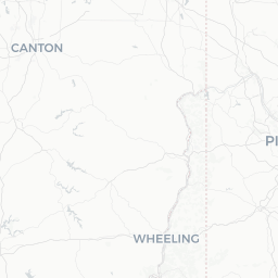
Keyser is the county seat of Mineral County in the Eastern Panhandle of West Virginia, situated where the North Branch of the Potomac River cuts through the Allegheny Mountains. With a population of roughly 5,200, it is a small but historically layered town that developed largely because of the Baltimore and Ohio Railroad, which ran through the region in the mid-19th century and shaped the local economy for generations.
The town sits at an elevation that gives it noticeably cooler summers than much of the mid-Atlantic region, making it a quiet retreat for those who enjoy river recreation, hiking, and fall color without large crowds. Potomac State College of West Virginia University anchors the local community and lends the town a modest but steady energy.
Keyser is not a major tourist hub, and visitors should set expectations accordingly — the appeal is landscape, history, and unhurried Appalachian character rather than polished attractions or a dense restaurant scene. It works well as a base for exploring the surrounding Potomac Highlands.
Before You Go
Visas & Entry
Keyser is located in the United States. For visa and entry requirements, check the TravelerPulse Visas section and the official U.S. Customs and Border Protection website for guidance specific to your nationality.
What to Pack
- Layered clothing is advisable year-round; temperatures drop sharply at night, especially spring and fall
- Rain gear — the region receives fairly consistent precipitation throughout the year
- Sturdy walking or hiking footwear if you plan to explore trails or riverbanks
- Cash — some local businesses may not accept cards; verify locally
Connectivity
Cell coverage can be patchy in surrounding mountain areas, though Keyser proper generally has adequate service from major US carriers. Download offline maps before venturing into backcountry areas nearby.
Getting There
By Car
Keyser is most practically reached by car. It lies along US Route 220 and is approximately 2.5 hours west of Baltimore, Maryland, and about 3 hours northwest of Washington, D.C. The drive through the mountains is scenic, particularly on the Maryland side via Route 220 through Cumberland.
By Bus
Limited regional bus or coach services may connect Keyser to larger cities. Verify current schedules and operators locally or through regional transit resources before your trip, as options in rural West Virginia change periodically.
Nearest Airports
The closest commercial airport is Eastern WV Regional Airport (MRB) in Martinsburg, WV, roughly 90 miles to the east, though service there is limited. Greater Pittsburgh International Airport (PIT) and Baltimore/Washington International (BWI) are the practical options for most visitors, each around 2.5–3 hours by car. Confirm current routes and rental car availability before booking.
Getting Around
A personal vehicle is essentially necessary for getting around Keyser and exploring the wider Mineral County area. The town itself is compact and walkable within the downtown core, but most natural attractions, recreation areas, and neighboring communities require driving.
There is no ride-share infrastructure reliably available in Keyser as of this writing — verify locally whether services like Uber or Lyft operate in the area. Fuel stations are available in town. Road conditions in winter can be challenging due to snow and ice; check WV511 or the West Virginia Division of Highways for road condition updates before traveling in colder months.
Things to See & Do
North Branch Potomac River
The river running along the edge of town is the natural centerpiece of the area. Fishing — particularly for smallmouth bass — is popular, and sections of the river attract kayakers and canoeists. Access points and conditions vary; check locally for current regulations and river levels.
Jennings Randolph Lake
Located a short drive south of Keyser near Elk Garden, this U.S. Army Corps of Engineers reservoir offers fishing, boating, camping, and hiking. It is one of the most significant recreational assets in Mineral County. Verify hours and fee information with the Corps of Engineers office or at the site.
Downtown Historic District
Keyser's compact downtown retains several 19th- and early 20th-century commercial and civic buildings that reflect the town's railroad-era prosperity. A self-guided walk is feasible; look for architectural details on the older brick storefronts and public buildings around the main commercial corridor.
Potomac State College Campus
The WVU campus sits on a hillside above the town and has attractive grounds. During academic semesters it brings some cultural programming to the area; check the college's calendar for public events.
Nearby Trails
The wider Allegheny Highlands region has trail networks accessible within a short drive. The Allegheny Highlands Trail and sections near the Monongahela National Forest to the west offer more extensive hiking options for those willing to travel 45–60 minutes.
Food & Drink
Keyser's dining scene is modest and local in character. Expect family-owned diners, pizza shops, and casual American fare rather than diverse international cuisine. Several small restaurants and fast-food options operate along the main commercial corridors.
Verify specific restaurant hours and current operation locally before your visit, as small-town establishments in this region sometimes keep limited hours or close seasonally. For a broader range of dining options, Cumberland, Maryland — about 20 miles to the northeast — has a noticeably larger restaurant scene.
The area has a small but genuine culture of home cooking and community events; check whether local festivals or community dinners coincide with your visit, as these can be among the most authentic food experiences the town offers.
Practical Information
Emergency Services
For emergencies in the United States, dial 911 for police, fire, or ambulance.
Medical
Mineral County has local medical facilities; for serious conditions, larger hospital services are available in Cumberland, Maryland. Verify current facility details locally.
Money
ATMs are available in town. As noted, carry some cash for smaller local businesses.
Time Zone
Eastern Time (ET): UTC−5 in winter, UTC−4 during Daylight Saving Time (March–November).
Weather
Winters can be cold with meaningful snowfall. Summer highs are generally moderate. Always check a current forecast before outdoor activities, as mountain weather can shift quickly.
Safety
Keyser is a small, generally low-key community. Visitors should take standard precautions — secure valuables in vehicles and be aware of surroundings, particularly after dark in less-trafficked areas.
When hiking or accessing the river in surrounding areas, inform someone of your plans and expected return, as cell service is unreliable in backcountry spots. River conditions on the North Branch Potomac can change with rainfall; check water levels before paddling or wading. In winter, mountain roads can ice over quickly — exercise caution and carry emergency supplies in your vehicle.