Overview
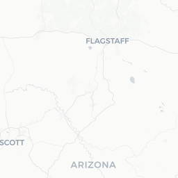
Wilhoit is a small, unincorporated rural community in Yavapai County, Arizona, sitting at roughly 4,800 feet elevation in the foothills of the Bradshaw Mountains. With a population of under 900, it functions primarily as a quiet residential area rather than a conventional tourist destination.
The surrounding landscape is characterized by high-desert chaparral, pinyon-juniper woodland, and the broader reaches of Prescott National Forest. Visitors typically pass through on State Route 89 while traveling between Prescott and the communities to the south, or seek out the area deliberately for dispersed outdoor recreation and solitude.
Because Wilhoit has no developed commercial district to speak of, travelers should arrive self-sufficient — with fuel, food, water, and any supplies they need. The nearest substantial services are in Prescott, approximately 20 miles to the north.
Before You Go
Visas and Entry
Wilhoit is a domestic U.S. destination. International visitors should check TravelerPulse's Visas section and the U.S. Customs and Border Protection website for current entry requirements.
What to Pack
- Layered clothing: Elevation means cooler nights even in summer; winters can bring freezing temperatures and occasional snow.
- Water: Carry more than you think you need, especially for outdoor activities.
- Fuel: Fill up before leaving Prescott or Mayer. There are no reliable fuel stations in Wilhoit itself.
- Cell coverage: Mobile signal can be patchy in the Bradshaw foothills. Download offline maps before you arrive.
Health Considerations
Sun exposure at elevation is intense. Use broad-spectrum sunscreen, a hat, and UV-protective clothing. Rattlesnakes and scorpions are present in the area; watch where you place hands and feet in rocky terrain.
Getting There
By Car
Wilhoit sits along State Route 89, the main corridor connecting Prescott (roughly 20 miles north) to Mayer and Cordes Junction to the south. From Phoenix, the most common route is I-17 north to Cordes Junction, then SR-69 west to Mayer, and north on SR-89. Allow approximately 90 minutes from central Phoenix under normal conditions.
Nearest Airports
The closest commercial airport is Prescott Regional Airport (PRC), which offers limited scheduled service. Phoenix Sky Harbor International Airport (PHX) is the most practical entry point for most travelers, with a full range of carriers and car-rental options. A rental car is essentially required to reach Wilhoit.
Public Transportation
No scheduled public transit serves Wilhoit directly. Yavapai County regional transit options are limited; verify current routes and schedules with the regional transit authority before planning your trip.
Getting Around
A personal vehicle is the only practical means of getting around Wilhoit and the surrounding area. State Route 89 is well-maintained, but forest roads branching into Prescott National Forest vary significantly in condition and may require a high-clearance or four-wheel-drive vehicle, particularly after rain or winter weather. Check current road conditions with the Prescott National Forest ranger district before venturing onto unpaved routes.
Things to See & Do
Prescott National Forest Access
The Bradshaw Ranger District of Prescott National Forest surrounds the Wilhoit area. Opportunities for dispersed camping, hiking, mountain biking, and wildlife observation are available on national forest land, subject to current fire restrictions and land-use rules. Verify permit requirements and any active fire or closure orders on the U.S. Forest Service website before your visit.
Scenic Driving
SR-89 through this stretch of Yavapai County offers pleasant high-desert scenery. The drive north toward Prescott becomes increasingly scenic as you gain elevation through the Bradshaw foothills.
Stargazing
Low light pollution and high elevation make the area reasonably good for stargazing on clear nights. Bring a red-light flashlight and appropriate cold-weather gear if you plan to stay out after dark, as temperatures drop quickly.
Nearby Day Trips
Most organized attractions, restaurants, and cultural sites are located in Prescott. See the Nearby section for suggestions.
Food & Drink
Wilhoit has no established restaurant or grocery infrastructure that travelers can reliably count on. Stock up on food, snacks, and water before arriving — Prescott to the north and Mayer to the south are your best options for provisioning.
Prescott offers a wide range of dining, from casual cafes on Courthouse Plaza to sit-down restaurants, and several grocery stores. If you are camping or spending extended time in the forest, plan all meals in advance.
Practical Information
Emergency Services
Yavapai County Sheriff's Office covers the Wilhoit area. For any emergency, dial 911. The nearest hospitals are in Prescott; verify current facility locations and capabilities locally.
Fire Restrictions
Arizona's fire seasons are serious. Prescott National Forest regularly implements fire restrictions that may prohibit campfires, charcoal, and certain stoves. Always check current restriction levels on the U.S. Forest Service website or by calling the Bradshaw Ranger District before your visit.
Weather
Summer monsoon season (roughly July–September) can bring sudden, heavy afternoon thunderstorms that cause flash flooding, particularly in low-lying areas and washes. Never attempt to drive through a flooded wash. Winter storms can bring snow and ice to SR-89; check ADOT road conditions at az511.gov before winter travel.
Connectivity
Assume limited or no cell service in portions of the area. Download maps, trail data, and any necessary information before leaving a reliable signal area.
Safety
Wilhoit is a low-key rural community and serious crime is not a notable concern for visitors. The more relevant safety considerations are environmental: extreme heat is possible in late spring and summer even at elevation, flash flooding during monsoon season presents a real risk, and the rugged terrain of the surrounding forest demands proper preparation.
Always tell someone your plans if heading into the forest. Carry a paper map as a backup to digital navigation. Carry adequate water — a commonly cited guideline for desert hiking is at least one liter per hour of activity, though needs vary by individual and conditions.