Overview
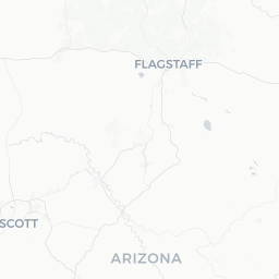
Yarnell is a small unincorporated community in Yavapai County, Arizona, situated at roughly 4,800 feet elevation in the Weaver Mountains along the Prescott Highway (SR 89). With a population under 700, it is a quiet, off-the-beaten-path stop that draws visitors for its dramatic granite boulder formations, sweeping views of the Sonoran Desert below, and the solemn history tied to the 2013 Yarnell Hill Fire.
On June 30, 2013, nineteen members of the Granite Mountain Hotshots — an elite wildland firefighting crew based in Prescott — lost their lives fighting a fast-moving wildfire near the town. That event shaped Yarnell's identity in a profound way, and the Granite Mountain Hotshots Memorial State Park, established nearby, has become the primary reason most visitors make the journey here.
Beyond the memorial, Yarnell retains a small-town character with a handful of local businesses, artists, and long-term residents who have rebuilt since the fire. The surrounding landscape of chaparral, manzanita, and granite outcrops rewards hikers and photographers, particularly in the cooler months.
Before You Go
Visas & Entry
Yarnell is in the continental United States. For visa and entry requirements, check TravelerPulse's Visas section and consult the U.S. Citizenship and Immigration Services (USCIS) official website.
Climate
Yarnell's elevation moderates the desert heat considerably compared to the Phoenix valley, but summers (June–August) are still warm and prone to monsoon thunderstorms. Winters can bring frost and occasional snow. Spring and fall are the most comfortable seasons for outdoor activity.
What to Pack
- Sturdy hiking footwear for rocky trails
- Sun protection (sunscreen, hat, sunglasses) year-round
- Layers in winter; the temperature drops sharply at night
- Sufficient water — services in town are limited
- Cash, as some small local vendors may not accept cards
Practical Heads-Up
Yarnell has very limited commercial infrastructure. Fuel, groceries, and lodging options are sparse. Plan to bring or purchase supplies before arriving, and verify that any specific business is still operating before you visit.
Getting There
By Car
Yarnell sits on State Route 89 between Wickenburg (roughly 25 miles south) and Prescott (roughly 35 miles north). Driving is the only practical way to reach the town. The road climbs sharply from the desert floor via a winding grade — exercise caution, particularly in wet or icy winter conditions and when towing trailers.
Nearest Airports
Phoenix Sky Harbor International Airport is approximately 90 miles southeast and is the closest major airport. Prescott Regional Airport (Ernest A. Love Field) is closer but serves limited routes; verify current schedules before booking. A rental car is essential from either airport.
Public Transit
There is no regular public bus or shuttle service to Yarnell. Visitors should plan on a private vehicle.
Getting Around
Yarnell is small enough that the town center and main roadside businesses are accessible on foot once you have parked. However, the Granite Mountain Hotshots Memorial State Park trailhead is a separate drive from the center of town — check current directions with Arizona State Parks before your visit, as access roads can vary.
A personal vehicle is essential for exploring the surrounding area, including the descent to Peeples Valley and onward drives toward Prescott or Wickenburg.
Where to Stay
Lodging options in Yarnell itself are very limited. A small number of independent motels and bed-and-breakfast properties have operated in and around town, but availability and operating status can change; verify locally or through a booking platform before travel.
Most visitors treat Yarnell as a day trip from Wickenburg, which has a broader range of hotels and motels, or from Prescott, which offers the widest variety of accommodation in the region including historic downtown hotels, chain properties, and vacation rentals.
Things to See & Do
Granite Mountain Hotshots Memorial State Park
This is Yarnell's most significant attraction. The park commemorates the nineteen firefighters who died in the 2013 Yarnell Hill Fire. The main trail leads hikers to the deployment site where the crew made their last stand. The hike is strenuous — roughly 9 miles round-trip with significant elevation change — and passes through rugged chaparral terrain. Visitors are encouraged to approach the site with solemnity and respect. Verify current park hours, trail conditions, and any fee or permit requirements directly with Arizona State Parks before visiting.
Scenic Driving & Photography
The stretch of SR 89 descending from Yarnell toward Wickenburg offers dramatic panoramic views of the Sonoran Desert and the Date Creek Mountains. The granite boulder landscape around town is photogenic, particularly in the soft light of early morning or late afternoon.
Peeples Valley
The small farming community of Peeples Valley lies just a short distance north of Yarnell and offers a glimpse of rural Arizona ranching life. It is a quiet detour rather than a destination in itself.
Local Art & Studios
Yarnell has a small artist community. A handful of galleries and studios have operated in town over the years — availability varies, so inquire locally about who is currently open.
Food & Drink
Dining options in Yarnell are limited and change over time. A small number of casual local eateries and diners have operated along SR 89 through the town, but visitors should verify current openings before relying on them. It is advisable to carry snacks and water, and to consider having a full meal in Wickenburg or Prescott before or after your visit.
There are no bars or notable nightlife in Yarnell. The community is quiet in the evenings.
Practical Information
Emergency Services
For any emergency in the United States, dial 911. The nearest hospital facilities are in Prescott or Wickenburg; Yarnell itself does not have a hospital.
Connectivity
Cell coverage in Yarnell can be patchy depending on your carrier. Do not rely solely on GPS navigation or a mobile data connection — download offline maps before arrival.
Fuel
Verify fuel availability in Yarnell before arrival, as service station hours and operations in very small Arizona towns can be irregular. Fill your tank in Wickenburg or Prescott to be safe.
Respectful Visitation at the Memorial
The Granite Mountain Hotshots Memorial is a place of mourning for many Arizona families and firefighting communities. Visitors are asked to remain quiet and respectful, stay on designated trails, and refrain from removing any natural or placed items from the site.
Safety
Yarnell is a low-crime rural community. The primary safety considerations are environmental rather than social.
- Wildfire risk: The area has a documented history of fast-moving wildfire, particularly in hot, dry, windy conditions. Check current fire restrictions and alerts with the Arizona Department of Forestry and Fire Management before any outdoor activity.
- Heat: Even at 4,800 feet, summer temperatures can be high. Carry ample water on any hike.
- Road conditions: The SR 89 grade into Yarnell can be hazardous in wet or icy weather, or for vehicles with overheating issues on the climb. Check road conditions in winter.
- Wildlife: Rattlesnakes, scorpions, and other desert wildlife are present. Watch where you step, especially on rocky terrain.