Overview
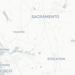
Fetters Hot Springs-Agua Caliente is a small, unincorporated census-designated place in Sonoma County, California, situated along the floor of Sonoma Valley just north of the town of Sonoma. With a population of around 4,000, it functions primarily as a residential community rather than a conventional tourist destination, but its location puts visitors within easy reach of some of Northern California's most celebrated wine country.
The hyphenated name reflects two historically distinct communities that grew up around natural geothermal springs in the area. "Agua Caliente" is Spanish for "hot water," and both settlements built modest resort and spa economies around the springs during the late 19th and early 20th centuries. Much of that resort infrastructure no longer exists, but the name endures and the geothermal character of the land remains part of local identity.
Today the area sits along Highway 12, the main artery through Sonoma Valley, placing it between the city of Sonoma to the south and Kenwood to the north. Travelers typically move through or base themselves here to access nearby wineries, state parks, and the historic town plaza of Sonoma. It is a genuinely quiet, neighborhood-oriented place — not a polished resort town — and visitors should calibrate their expectations accordingly.
Before You Go
No visa-specific rules are listed here. For current entry requirements to the United States, check TravelerPulse's Visas section and the official U.S. Customs and Border Protection website.
Fetters Hot Springs-Agua Caliente has very limited traveler infrastructure of its own. There are no major hotels, tourist information offices, or visitor centers within the CDP itself. Plan accommodation, dining, and activity bookings in advance using nearby Sonoma or other Valley towns as reference points.
What to Pack
- Layered clothing is advisable year-round; mornings and evenings in the valley can be cool even in summer
- Sun protection for vineyard and outdoor visits during spring and summer
- A car or rideshare plan is essential — public transit options are limited
Wildfires are a seasonal concern in Sonoma County, particularly in late summer and fall. Before and during travel, monitor conditions through Sonoma County's official emergency services and CAL FIRE. Air quality can be affected during fire season.
Getting There
The nearest major airport is Charles M. Schulz–Sonoma County Airport (STS) in Santa Rosa, approximately 15–20 minutes north by car. San Francisco International Airport (SFO) and Oakland International Airport (OAK) are larger hubs roughly 50–60 miles to the south, making them common arrival points for international travelers; expect 60–90 minutes of driving depending on traffic.
By car, the area is accessible via Highway 12 through Sonoma Valley. From San Francisco, the most common route crosses the Golden Gate Bridge and heads north on U.S. 101, then east on Highway 37 or Highway 116 to connect with Highway 12. Verify current routing and road conditions locally, as options vary.
Sonoma County Transit operates bus routes in the broader region, and some connections to Sonoma town are available, but service to and within Fetters Hot Springs-Agua Caliente specifically is limited. Verify current schedules at the Sonoma County Transit website before relying on buses for your trip.
Getting Around
A personal vehicle is by far the most practical way to get around this area. The community sits along Highway 12, and most wineries, parks, and dining options require driving between points. Road shoulders and bike lanes exist along some stretches of Highway 12, but cycling alongside traffic on this corridor demands caution.
Rideshare services such as Uber and Lyft operate in Sonoma Valley, though availability can be limited during peak wine country weekends or late evenings. If you plan to visit multiple wineries in a day, hiring a designated driver service or joining a wine tour is a safer and often more practical option — these are widely available in Sonoma Valley. Verify current operators and pricing locally.
Things to See & Do
The primary draw for visitors to this area is Sonoma Valley's wine country. Dozens of tasting rooms and winery estates are accessible within a short drive, ranging from small family operations to larger recognized estates. The concentration of wineries along Highway 12 and the Sonoma Valley floor means that much of the wine country experience is accessible without extensive travel.
Sugarloaf Ridge State Park, located a few miles northeast near Kenwood, offers hiking trails with views across Sonoma and Napa valleys, including routes to Bald Mountain. The park also has a campground and a small astronomical observatory — verify current hours and reservation requirements through California State Parks before visiting.
The historic Sonoma Plaza, a short drive south, is one of the largest town plazas in California and is surrounded by historic adobe buildings, including Sonoma State Historic Park sites that include the last of the California missions and the Sonoma Barracks. Admission policies and hours should be confirmed through California State Parks.
Nearby Outdoor Recreation
- Sonoma Valley Regional Park offers trails and open space accessible from the valley floor
- The Sonoma Overlook Trail, accessed from Sonoma town, provides elevated valley views
- Spring and fall bring pleasant conditions for cycling on quieter back roads off Highway 12
Food & Drink
Fetters Hot Springs-Agua Caliente itself has minimal standalone dining — residents typically travel to Sonoma town or El Verano for restaurants and grocery shopping. The town of Sonoma, a short drive south, has a well-developed dining scene ranging from casual taquerias around the plaza to wine-country-focused restaurants with local and seasonal menus.
Glen Ellen, a small village a few miles north, has a handful of well-regarded dining options and is worth considering for a meal during any valley exploration. Kenwood, further north along Highway 12, also has dining options catering to wine country visitors.
Many Sonoma Valley wineries offer food pairings or picnic facilities alongside their tastings — check individual winery websites for current offerings and reservation requirements, as policies vary and some require advance booking.
Practical Information
Emergency Services
For any emergency in the United States, dial 911. Verify the location of the nearest hospital or urgent care clinic before your trip — Sonoma Valley Hospital in Sonoma serves the local area, but confirm current services and hours directly.
Connectivity
Cell service and mobile data are generally available in the valley corridor, though signal can drop in canyon areas or more remote parts of the surrounding hills. Most accommodations in the broader Sonoma Valley area offer Wi-Fi.
Practical Notes
- California has strict open-container laws; consuming alcohol in vehicles or public spaces is prohibited
- Sonoma County enforces fire restrictions seasonally; check current conditions before any campfire or outdoor cooking
- Tipping is customary in U.S. restaurants and for service workers; 18–20% is standard for sit-down dining
Safety
Fetters Hot Springs-Agua Caliente is a quiet residential area with no particular safety concerns for visitors beyond those common to rural California. Wildfire is the most significant environmental hazard; Sonoma County has experienced major fire events in recent years. Travelers should stay informed through local emergency alerts, keep an eye on CAL FIRE updates during dry season, and be aware of any evacuation orders or road closures in effect.
When driving through wine country, be mindful that Highway 12 can be busy on weekends and that alcohol-related impairment is a risk in wine tourism areas. Use a designated driver, rideshare, or tour service when visiting multiple tasting rooms.