Overview
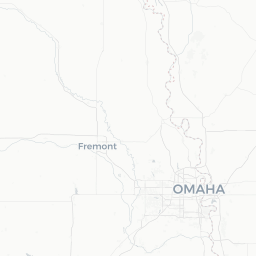
Fort Calhoun is a small village of roughly 900 residents situated in Washington County, Nebraska, on a bluff above the Missouri River about 18 miles north of Omaha. It sits in one of the most historically significant corridors in the American Midwest — the stretch of river traveled by the Lewis and Clark Expedition in 1804 and again in 1806.
Despite its modest size, Fort Calhoun punches above its weight for history enthusiasts. The site of Fort Atkinson, the first U.S. military fort west of the Missouri River, is preserved nearby as a state historical park, making the area a genuine destination for those interested in early American exploration and frontier history.
The surrounding landscape — rolling bluffs, river bottomland, and tall-grass prairie remnants — offers a quieter, more contemplative version of the Great Plains than visitors typically find in larger Nebraska cities. For travelers already visiting the Omaha metro area, Fort Calhoun is an easy and rewarding half-day detour.
Getting There
Fort Calhoun is most practically reached by personal vehicle. It lies approximately 18 miles north of downtown Omaha via US-75 North, a straightforward drive of roughly 25–30 minutes depending on traffic.
Nearest major airport: Omaha's Eppley Airfield (OMA) is the logical gateway, served by multiple major U.S. carriers. From the airport, Fort Calhoun is a short drive north.
Public transportation connections between Omaha and Fort Calhoun are limited; verify any current bus or transit options locally, as service to small rural communities can change. Renting a car at Eppley Airfield is the most practical approach for most visitors.
Getting Around
Fort Calhoun itself is compact and walkable within the village core, but reaching Fort Atkinson State Historical Park and DeSoto National Wildlife Refuge requires a vehicle. There is no local public transit or ride-share infrastructure reliably operating in the village.
A personal or rental car is strongly recommended for anyone planning to visit the area's historical and natural sites. Roads in the area are generally in good condition, and rural driving is straightforward.
Where to Stay
There are no major hotels within Fort Calhoun village itself. Visitors typically base themselves in the Omaha metro area or in Blair, Nebraska, and make Fort Calhoun a day trip.
Blair offers some motel and lodging options; verify availability and current properties on booking platforms before your trip. Omaha provides the full spectrum of accommodation from budget chains to full-service hotels, and the drive to Fort Calhoun from Omaha takes under 30 minutes.
Things to See & Do
Fort Atkinson State Historical Park
This is the primary reason most visitors come to Fort Calhoun. Fort Atkinson was established in 1820 and served as the largest U.S. military installation of its era before being abandoned in 1827. The state historical park features a reconstructed fort, living-history demonstrations during the warmer months, interpretive exhibits, and trails across the original footprint of the post. Admission fees and seasonal hours should be verified directly with Nebraska Game and Parks (outdoornebraska.gov) before your visit.
Lewis & Clark Connection
The bluffs near Fort Calhoun were noted in the journals of the Lewis and Clark Expedition. The Council Bluff area — the actual bluff on the Nebraska side — is where the Corps of Discovery held their first formal council with Native American leaders (the Oto and Missouri peoples) in August 1804. Interpretive signage in the area helps contextualize this moment in U.S. history.
Outdoor Recreation
- DeSoto National Wildlife Refuge is a short drive north and offers excellent birding, particularly during fall waterfowl migration, as well as a visitor center featuring artifacts recovered from the 1865 steamboat Bertrand.
- The Missouri River bottomlands and surrounding Washington County countryside are pleasant for scenic drives, especially in autumn foliage season.
- Local walking and nature areas provide low-key outdoor time in a peaceful setting.
Food & Drink
Dining options within Fort Calhoun village itself are very limited given the population size. Visitors should not expect a wide restaurant scene. A small number of local establishments may be present — verify what is currently operating before your visit, as small-town businesses can open and close.
For a broader range of dining, Blair (the Washington County seat, about 10 miles north) and the Omaha metro area (about 18 miles south) offer far more options spanning casual American fare, regional cuisine, and national chains.
Packaging snacks and water before arriving is a practical habit for a day trip to this area, particularly if you plan to spend extended time at Fort Atkinson or DeSoto.
Practical Information
Visas & Entry
Fort Calhoun is in the United States. For visa and entry requirements, check TravelerPulse's Visas section and the official U.S. Customs and Border Protection website (cbp.gov) for current requirements relevant to your nationality.
Money
The US Dollar is the only currency used. ATM availability in Fort Calhoun village is limited; plan to have cash on hand or rely on card payments. Fill up on fuel in Omaha or Blair rather than counting on local stations.
Connectivity
Cell service in the area is generally adequate along US-75 and in the village, though rural stretches and some bottomland areas near the river may have weaker signal. Download offline maps before your visit.
Seasonal Notes
- Fort Atkinson's living-history programming and full visitor services typically operate in the warmer months (roughly Memorial Day through Labor Day); verify the current schedule with Nebraska Game and Parks.
- Winters in this part of Nebraska can bring significant cold, snow, and ice. Some outdoor sites may have limited access or reduced hours.
- DeSoto National Wildlife Refuge's peak birding for snow geese and waterfowl typically falls in late October through November.
Safety
Fort Calhoun is a quiet, low-crime rural community. Standard common-sense travel precautions apply: secure your vehicle and belongings, particularly at trailheads and park areas.
When visiting the Missouri River bluffs or bottomlands, be aware of uneven terrain and seasonal conditions. During spring flooding periods, low-lying roads near the river can be affected — check local road conditions if traveling in March through May. For emergencies, dial 911.