Overview
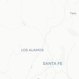
Pojoaque (pronounced poh-HWAH-keh) is a small community in northern New Mexico, situated about 16 miles north of Santa Fe along US Highway 84/285. With a population of fewer than 2,000 people, it is less a conventional city and more a hub for the surrounding Pojoaque Pueblo, one of the Eight Northern Pueblos of New Mexico.
The area sits in the Rio Pojoaque valley at roughly 5,600 feet elevation, flanked by the Jemez Mountains to the west and the Sangre de Cristo range to the east. The landscape is classic high desert — juniper and piñon pine scrub, wide skies, and golden light that has attracted artists and photographers for generations.
Pojoaque serves primarily as a commercial and cultural crossroads. Travelers pass through on their way to Taos, Abiquiú, Bandelier National Monument, or the pueblos of the Española Valley. Despite its modest size, the community offers a genuine window into living Pueblo culture, Southwestern art, and the layered Hispanic and Indigenous heritage of this region.
Before You Go
Visas
Pojoaque is located within the United States. For visa requirements, check TravelerPulse's Visas section and consult the U.S. Customs and Border Protection or your country's official immigration authority before travel.
Altitude Awareness
Pojoaque sits above 5,500 feet. Visitors coming from low-altitude areas may experience mild altitude symptoms — headaches, fatigue, or dehydration — in the first day or two. Drink extra water and limit strenuous activity on arrival.
Pueblo Land Protocols
Pojoaque Pueblo is sovereign land. Certain areas, ceremonies, and events may be restricted to tribal members. Always check with the Pojoaque Pueblo Governor's Office or the official pueblo website before visiting cultural sites, attending dances, or taking photographs. Unauthorized photography of ceremonies or sacred spaces is prohibited and disrespectful.
Climate Notes
Summers are warm with afternoon monsoon thunderstorms common July through September. Winters bring cold nights and occasional snow. Spring and fall are generally pleasant, with mild daytime temperatures and cool evenings. Layers are advisable year-round.
Getting There
By Air
The nearest major airport is Santa Fe Regional Airport (SAF), approximately 20 miles south. Albuquerque International Sunport (ABQ), roughly 60 miles to the south, offers significantly more flight options and is the primary gateway for most visitors to northern New Mexico. Car rental is available at both airports.
By Car
Pojoaque sits directly on US Highway 84/285, making it straightforward to reach by car from Santa Fe (about 20–25 minutes) or Albuquerque (about 60–75 minutes under normal conditions). This is by far the most practical way to arrive, as the surrounding region is not well served by public transit.
By Bus
New Mexico Rail Runner Express connects Albuquerque to Santa Fe; from there, the North Central Regional Transit District (NCRTD) operates bus routes into the Española Valley and surrounding communities, with stops in the Pojoaque area. Schedules and routes should be verified directly with NCRTD, as service frequency is limited.
Getting Around
A personal vehicle is essentially required to get around Pojoaque and the surrounding region. The community is spread out along the highway corridor, and distances between attractions, the pueblo cultural center, and nearby sites are not walkable.
The NCRTD Blue Bus serves parts of this corridor but is designed primarily for local commuters, not tourists. Verify current schedules on the NCRTD website before relying on it. Rideshare services are available but coverage can be inconsistent this far from Santa Fe. Renting a car in Albuquerque or Santa Fe is the most reliable option for independent exploration.
Things to See & Do
Pojoaque Pueblo Cultural Sites
The Pueblo of Pojoaque operates the Poeh Cultural Center and Museum, which documents the history, art, and traditions of the Tewa-speaking people of the Eight Northern Pueblos. The museum features rotating and permanent exhibits of pottery, weaving, jewelry, and historical photographs. Verify current hours and any admission fees directly with the center before visiting.
Cities of Gold Casino and Hotel
The Pueblo of Pojoaque operates Cities of Gold Casino, a full-service casino with gaming, dining, and entertainment. The adjacent hotel and sports facility make this the largest commercial complex in the immediate area. Check the official Cities of Gold website for current events and offerings.
Buffalo Thunder Resort and Casino
Also operated by Pojoaque Pueblo, Buffalo Thunder is a larger resort property featuring a casino, spa, golf course, and multiple dining outlets. It hosts events and cultural programming periodically throughout the year.
Day Trips and Scenic Drives
Pojoaque's greatest asset for visitors may be its location. The Low Road to Taos (NM-68 via Española) follows the Rio Grande canyon and is a striking drive. The High Road to Taos (through Chimayó, Truchas, and Las Trampas) passes through mountain villages with centuries-old churches and active weaving and woodcarving traditions. Bandelier National Monument, with its ancestral Pueblo cliff dwellings, is about 30 minutes away. The village of Chimayó and its renowned Santuario are roughly 10 miles east.
Food & Drink
Pojoaque itself has limited standalone dining options beyond what is offered within the casino resort properties. The restaurants at Cities of Gold and Buffalo Thunder cover a range of price points and styles, from buffet to sit-down meals, and include some New Mexican cuisine featuring red and green chile.
For a broader dining scene, Santa Fe is 20–25 minutes south and has an extensive range of restaurants specializing in New Mexican, contemporary Southwestern, and international cuisine. The town of Española, about 10 miles north, has local diners and family-owned restaurants serving traditional northern New Mexico food at more modest prices.
If you are self-catering, there are grocery and convenience options along the US 84/285 corridor in Pojoaque and in nearby Española. Note that liquor sales on tribal land are governed by tribal ordinance — verify locally what is available where.
Shopping
The Poeh Cultural Center has a gift shop featuring work by Native artists from the Eight Northern Pueblos, including pottery, jewelry, and weavings. Purchasing here directly supports pueblo artists and cultural programs.
The casino resort properties have retail outlets with Southwestern gifts and Native-themed merchandise. For a wider selection of high-quality Indigenous and Hispanic art, Santa Fe's Canyon Road galleries and the Santa Fe Indian Market (held in August) are unmatched in the region. Chimayó, nearby on the High Road, is known for hand-woven Rio Grande–style textiles sold at several family-owned weaving studios.
Practical Information
Emergency Services
For emergencies, dial 911. Pojoaque is served by Santa Fe County emergency services. The nearest hospital with emergency services is in Santa Fe — verify the closest facility before you travel.
Cell Service and Internet
Cell coverage is generally adequate along the main highway corridor but can be spotty in canyon areas or on back roads. Download offline maps before heading into rural areas.
Fuel and Supplies
Fuel is available in Pojoaque along the highway. It is wise to fill up before heading into less-populated areas such as the High Road or toward Abiquiú.
Tipping
U.S. standard tipping applies: 18–20% at sit-down restaurants, a few dollars for housekeeping, and similar conventions at the resort properties.
Respect for Pueblo Sovereignty
Remember that Pueblo of Pojoaque land is a sovereign nation within the U.S. Tribal rules and regulations take precedence on tribal property. Behave respectfully, follow posted guidelines, and ask before taking any photographs of people or ceremonial spaces.
Safety
Pojoaque is generally a low-crime area and is considered safe for travelers. The primary safety considerations are environmental: summer monsoon storms can cause flash flooding on dry arroyos with little warning — take any flood warnings seriously and never attempt to drive through flooded roads.
Wildlife to be aware of in the broader region includes rattlesnakes (mostly in warmer months) and black bears in forest areas. These encounters are uncommon but standard backcountry precautions apply. Sun intensity at this elevation is significant — use sunscreen, sunglasses, and a hat even on overcast days.
Local Culture & Etiquette
Pojoaque Pueblo is one of the oldest continuously inhabited communities in what is now New Mexico, with Tewa-speaking peoples having lived in this valley for many centuries. The pueblo was nearly abandoned in the late 19th century following epidemic disease and displacement but has experienced a significant cultural and demographic revival in recent decades — a fact tribal members rightly regard with pride.
The Eight Northern Pueblos hold feast days throughout the year, typically tied to Catholic saints' days that were layered over existing ceremonial calendars during the Spanish colonial period. These events often include traditional dances, and some are open to respectful outside visitors. Dates and access rules change year to year — confirm with the Pojoaque Pueblo Governor's Office.
The surrounding region reflects a centuries-old confluence of Pueblo, Hispanic, and more recently Anglo-American cultures. Local cuisine, architecture, art forms, and place names all carry this layered heritage. Visitors will notice a mix of Spanish and Tewa place names throughout the area. Approaching this cultural richness with curiosity and humility — rather than treating it as a theme park backdrop — makes for a far more meaningful visit.