Translate
Overview
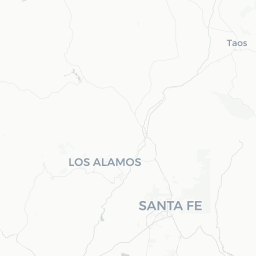
White Rock is a small, planned community of roughly 5,700 residents situated on the Pajarito Plateau in northern New Mexico, about 35 miles northwest of Santa Fe. It sits at an elevation of approximately 6,200 feet and was developed primarily to house workers and families associated with nearby Los Alamos National Laboratory. Despite its modest size, the town occupies a geographically dramatic setting: the eastern edge of the plateau drops sharply into the Rio Grande canyon, and the surrounding landscape is a mosaic of pinyon-juniper woodland, volcanic mesa, and ancient canyon systems.
The community is administratively part of Los Alamos County, the smallest county by area in New Mexico. Visitors do not come here for an urban experience — there are no major hotels or downtown commercial strips. Instead, White Rock serves primarily as a launching point for outdoor recreation and day trips to some of the most significant cultural and natural sites in the American Southwest.
The town's character is quiet and residential, with a well-educated population reflecting the scientific workforce of the laboratory. Travelers who make the effort to reach White Rock are typically rewarded with uncrowded trails, sweeping canyon vistas, and fast access to Bandelier National Monument — often without the heavier crowds that gather at trailheads closer to Santa Fe.
Before You Go
Visas and Entry
White Rock is located within the United States. For visa requirements, visit TravelerPulse's Visas section and consult the U.S. Customs and Border Protection website for current, authoritative guidance.
Altitude Awareness
At roughly 6,200 feet above sea level, White Rock and the surrounding Pajarito Plateau sit at a meaningful elevation. Visitors arriving from lower altitudes — particularly those flying into Albuquerque and driving directly — may experience mild altitude-related symptoms such as headaches or fatigue. Staying well hydrated, limiting alcohol on arrival day, and pacing physical activity for the first 24 hours are sensible precautions.
Weather and Seasonal Conditions
Summers are warm and generally dry until late June or July, when the Southwest monsoon brings afternoon thunderstorms almost daily through early September. Lightning is a real hazard on exposed ridges and canyon rims during this period — plan hikes for early morning. Winters can bring snow and freezing temperatures; some unpaved roads and trail sections in the area may become icy or impassable. Spring and autumn offer the most stable, pleasant conditions for outdoor activities.
What to Pack
- Sun protection (sunscreen, hat, UV-blocking clothing) — UV intensity is elevated at altitude
- Sufficient water; carry more than you think you need for any hike
- Layers for rapid temperature swings, especially in spring and autumn
- Sturdy closed-toe footwear for canyon trails
Getting There
By Air
The nearest commercial airport with regular service is Albuquerque International Sunport (ABQ), approximately 60–70 miles south. The drive from Albuquerque to White Rock takes roughly 60–75 minutes via NM-502 depending on traffic and conditions. Santa Fe Municipal Airport (SAF) is closer in distance but has very limited scheduled service; verify current routes before planning around it.
By Car
A personal vehicle or rental car is by far the most practical way to reach White Rock and to move around once there. From Albuquerque, take I-25 north to Pojoaque, then NM-502 west up the mesa. From Santa Fe, take US-285/84 north to Pojoaque and then NM-502 west. The road up the mesa is well maintained but involves a steep, winding climb — exercise caution in winter conditions.
By Public Transit
New Mexico Rail Runner Express connects Albuquerque to Santa Fe. From Santa Fe, the North Central Regional Transit District (NCRTD) operates bus routes toward Los Alamos and White Rock, though schedules are limited and a car is still strongly recommended. Verify current NCRTD schedules on their official website before relying on this option.
Getting Around
White Rock is a small, car-dependent community. Most visitors will need a personal or rental vehicle to access trailheads, the overlook, and neighboring areas such as Los Alamos and Bandelier National Monument. There are no ride-share services reliably operating in this area — verify locally before assuming availability.
The NCRTD bus service does connect White Rock with Los Alamos and, on certain routes, with Española and Santa Fe, but service is infrequent. Within the town itself, distances are short enough that some sites are walkable or bikeable from residential areas, though the terrain includes significant elevation changes. A standard passenger car is sufficient for paved roads; a high-clearance vehicle is useful if you plan to explore unpaved forest roads on the plateau.
Things to See & Do
White Rock Overlook and Park
The White Rock Overlook, located at the eastern edge of town, is the community's most visited landmark. The viewpoint sits above a dramatic bend of the Rio Grande canyon, offering wide views of the river gorge, distant mountains, and — on clear days — a vast sweep of northern New Mexico's plateau and mesa country. A small park surrounds the overlook with picnic facilities. The trailhead for the Overlook Trail and the Redondo Trail system is nearby, giving access to canyon-rim hiking with varying levels of difficulty. Confirm current trail conditions locally before setting out.
Bandelier National Monument
Approximately 7 miles from White Rock, Bandelier protects the ancestral homeland of the Pueblo people, including cliff dwellings carved into volcanic tuff, petroglyphs, and extensive backcountry canyon wilderness. The main Frey Trail and the loop through Frijoles Canyon are accessible to most visitors. During peak season (typically late spring through early fall), timed-entry permits or a shuttle from White Rock may be required — verify current access requirements on the National Park Service website (nps.gov/band) before your visit.
Rio Grande Trail Access
Several trails descend from the mesa into the Rio Grande canyon. The Overlook Trail, the Cañon Trail, and the Frijoles Canyon trail in Bandelier all reach the river. These descents are strenuous and involve significant elevation change; they are best tackled in cooler morning hours with ample water.
Los Alamos
The neighboring city of Los Alamos, about 5 miles northwest, offers the Bradbury Science Museum — a free, publicly accessible institution operated by Los Alamos National Laboratory covering the lab's history, the Manhattan Project, and current science programs. The Los Alamos History Museum provides additional context. Both are worth a half-day.
Pajarito Mountain Ski Area
A small, community-focused ski and snowboard area operates on Pajarito Mountain west of Los Alamos during the winter season. Operating days and hours are limited; verify the current season schedule on their official site before planning a visit.
Food & Drink
White Rock itself has very limited dining options, primarily a small number of casual local eateries and a grocery store for self-catering. Most visitors eat in neighboring Los Alamos, which has a broader — though still modest — range of restaurants including New Mexican cuisine, pizza, and café-style establishments.
For a wider variety of dining, Santa Fe is about 35–40 minutes away and offers extensive options across all price ranges and cuisines, with particular strength in New Mexican and Southwestern food. If you are self-catering during a stay in the area, stock up in Los Alamos or, for more options, in Española or Santa Fe, as the White Rock grocery options are basic.
New Mexican cuisine — distinct from Mexican food — is the regional tradition: expect dishes centered on red and green chile sauces, posole, and blue corn. When ordering locally, the classic question is 'red or green?' referring to your chile preference; 'Christmas' means both.
Practical Information
Accommodation
White Rock has no hotels or established lodging within the town. Visitors typically stay in Los Alamos (limited hotel options — verify current availability on booking platforms), Santa Fe (much wider selection), or in vacation rentals in the broader area. Santa Fe is the most practical base if you want a full range of accommodation types and amenities.
Connectivity and Services
Cell coverage is generally available in White Rock and on the main roads, but can be intermittent in canyon areas and on backcountry trails. Download offline maps before heading into the backcountry. The town has basic services — a pharmacy, a grocery store, and a post office — but for banking, medical facilities, or specialty goods, Los Alamos or Santa Fe is more practical.
Emergency Services
For emergencies anywhere in the United States, dial 911. Los Alamos Medical Center is the nearest hospital; verify its current services and hours locally. In the backcountry, cell service cannot be relied upon — a personal locator beacon (PLB) or satellite communicator is a prudent addition to your kit if you plan extended hikes.
Fees and Permits
- Bandelier National Monument charges an entry fee; verify the current rate at nps.gov/band
- The White Rock Overlook park area is free to access (verify locally)
- Some backcountry areas fall under Santa Fe National Forest jurisdiction; check with the Española Ranger District for any permit requirements
Safety
White Rock is a quiet, low-crime residential community and is generally very safe for visitors. Standard common-sense precautions apply: secure valuables in your vehicle, particularly at trailheads, and be aware of your surroundings in unfamiliar areas.
The primary safety considerations here are environmental. Heat, sun exposure, and dehydration are significant risks on canyon trails, particularly in summer. Flash flooding can occur in canyon bottoms during the monsoon season with little warning — check forecasts and never camp in a wash. Wildlife in the area includes rattlesnakes, which are active in warm months; watch where you step and where you place your hands on rocky terrain.
Fire danger is a serious and ongoing concern across the Pajarito Plateau. Wildfires can move rapidly through the pinyon-juniper woodland. Check current fire restrictions with Santa Fe National Forest or the National Park Service before any visit, and observe all posted restrictions strictly. Some trails and areas may be closed due to fire or flood damage — verify access before departing.