Translate
Overview
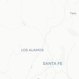
Agua Fria is a small, unincorporated community of roughly 2,800 residents situated just east of Santa Fe in north-central New Mexico, at an elevation of approximately 6,900 feet. Its name — Spanish for "cold water" — reflects the acequia-fed arroyos and springs that historically sustained settlement along this stretch of the Sangre de Cristo foothills.
The village sits along old routes that once formed part of the Camino Real, the colonial road connecting Mexico City to Santa Fe. Today it retains a quiet, residential character with adobe homes, pinon-juniper scrubland, and wide mesa views. It is not a tourist destination in the conventional sense — there are no major hotels, branded restaurants, or visitor attractions within the community itself — but it occupies a genuinely scenic position and functions well as a quiet base for exploring the greater Santa Fe area.
Travelers who end up in or near Agua Fria are typically drawn by proximity to Santa Fe's cultural institutions, the Turquoise Trail, or the open-space preserves on Santa Fe's southeastern edge. The community itself rewards slow, observational travel: unpaved roads, traditional land-use patterns, and a pace of life distinct from the downtown Santa Fe tourist corridor.
Before You Go
Visas and Entry
Agua Fria is in the United States. For visa and entry requirements, visit TravelerPulse's Visas section and check directly with the U.S. Customs and Border Protection or the relevant U.S. embassy or consulate for your country.
Climate
At roughly 6,900 feet, Agua Fria has a semi-arid high-desert climate. Summers (June–August) are warm with afternoon monsoon thunderstorms common from July onward. Winters bring cold nights, occasional snow, and sharp daytime sun. Spring and autumn are generally the most comfortable seasons for walking and outdoor activity.
What to Bring
- Sun protection (sunscreen, hat, sunglasses) — UV exposure is intense at high elevation year-round
- Layers for temperature swings between day and night, even in summer
- Water: carry more than you think you need in any dry season
- Cash for small local vendors, as card acceptance is inconsistent in rural areas
Connectivity
Cell coverage is generally adequate for major US carriers on the main roads, though it can be patchy on back roads. Verify your plan's coverage map before relying on data navigation in the area.
Getting There
By Air
The nearest commercial airport is Santa Fe Regional Airport (SAF), roughly 8–10 miles west of Agua Fria, with limited regional connections. Albuquerque International Sunport (ABQ), about 60 miles to the south, is the primary regional hub and offers far more flight options. Car rental is available at both airports.
By Road
Agua Fria lies east of US Route 285/84 and is most directly accessed via Old Las Vegas Highway or connecting roads off Interstate 25. From central Santa Fe the drive is typically under 15 minutes. From Albuquerque, I-25 north to the Santa Fe area takes roughly one hour under normal conditions.
By Bus
New Mexico Rail Runner Express connects Albuquerque to the Santa Fe Depot; from there, local transit or rideshare would be needed to reach Agua Fria. Verify current schedules and fares at the NM Rail Runner's official site before travel.
Getting Around
A personal vehicle is strongly recommended for getting around Agua Fria and the surrounding area. The community has limited pedestrian infrastructure and no local transit service of its own. Santa Fe's city bus system (Santa Fe Trails) serves parts of the broader region — verify current routes and stops on the City of Santa Fe's official transit pages.
Rideshare apps (Uber, Lyft) operate in the Santa Fe metro area but coverage and wait times can be unpredictable in outlying communities like Agua Fria, particularly at night. Taxis are available in Santa Fe proper.
Many of the unpaved roads around the community can become muddy or slippery after monsoon rain. If you plan to drive gravel or dirt roads, a vehicle with reasonable ground clearance is advisable.
Things to See & Do
Agua Fria's own footprint is small, and most notable activities involve the surrounding landscape and nearby Santa Fe. That said, the area offers genuine appeal for travelers who value open space and history.
Nearby Open Space and Trails
Santa Fe's Dale Ball Trails and the Atalaya Mountain trail system are accessible within a short drive and offer well-marked hiking in pinon-juniper and ponderosa pine terrain with views across the Rio Grande Valley. Verify trailhead access and conditions locally before setting out.
Historic Landscape
The old alignment of the Camino Real passes through this corridor. Interpretive resources at the New Mexico History Museum in Santa Fe (a short drive away) provide context for the colonial and pre-colonial significance of the region.
Day Trips from Agua Fria
- Santa Fe Plaza and Museum Hill: World-class museums including the Museum of Indian Arts and Culture and the Museum of International Folk Art are approximately 15–20 minutes by car
- Turquoise Trail (NM-14): A scenic byway south through Madrid and Cerrillos toward Albuquerque
- Bandelier National Monument: Ancestral Pueblo cliff dwellings roughly 45 miles northwest; verify hours and timed-entry requirements on the NPS website before visiting
- Pecos National Historical Park: Pueblo and Spanish colonial ruins about 25 miles east; check NPS site for current access
Food & Drink
There are no established restaurants or cafes within Agua Fria village itself. Visitors should plan meals in Santa Fe, where a wide range of dining options exists — from traditional New Mexican cuisine (red and green chile, posole, sopapillas) to international restaurants along Guadalupe Street and in the downtown district.
For groceries and self-catering supplies, several supermarkets and a Trader Joe's operate in Santa Fe proper. Visitors staying in the Agua Fria area and cooking for themselves will find the closest stores along Cerrillos Road or St. Francis Drive in Santa Fe. Verify current hours locally.
New Mexico produces wine and craft spirits; Santa Fe has a number of tasting venues and craft breweries worth seeking out if that interests you — again, verify operating hours before visiting.
Practical Information
Emergency Services
For any emergency in the United States, dial 911. The primary hospital serving the Santa Fe area is Christus St. Vincent Regional Medical Center in Santa Fe. Verify the address and any urgent-care alternatives locally upon arrival.
Money
US dollars are the only accepted currency. ATMs are available in Santa Fe; there are none known within Agua Fria village itself. Credit and debit cards are accepted at most Santa Fe businesses.
Connectivity and Postal Services
The Agua Fria area uses Santa Fe-area postal infrastructure. For postal needs, the nearest USPS locations are in Santa Fe — verify current hours on USPS.com.
Elevation
At nearly 7,000 feet, some visitors experience mild altitude effects (headache, fatigue, shortness of breath) for the first day or two. Stay hydrated, limit strenuous activity initially, and consult a doctor before travel if you have cardiovascular or respiratory conditions.
Safety
Agua Fria is a quiet residential community and is generally safe. Standard precautions applicable to rural areas apply: avoid leaving valuables visible in parked vehicles, be aware of your surroundings on unfamiliar roads after dark, and let someone know your plans if you are hiking in remote areas.
Wildfire risk in northern New Mexico can be significant, particularly in spring and early summer before monsoon season. Check current fire restrictions with the Santa Fe National Forest or New Mexico State Forestry before any outdoor activity. During monsoon season (roughly July–September), arroyos can flash-flood quickly — never enter a flooded wash.
Road conditions on unpaved surfaces can change rapidly after rain. If driving gravel roads in the area, check weather forecasts and allow extra time.