Overview
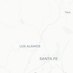
Los Alamos sits on a series of mesas in the Jemez Mountains of northern New Mexico, roughly 35 miles northwest of Santa Fe, at an elevation of about 7,300 feet. It is one of the more unusual small cities in the United States: founded in secrecy in 1943 as the headquarters of the Manhattan Project, it was the place where the first atomic bombs were designed and built. The community that grew up around Los Alamos National Laboratory (LANL) has never fully shed that identity, and today science and history are woven into the fabric of everyday life here.
Despite its small population of around 12,000, the city punches well above its weight in terms of intellectual culture, outdoor recreation, and historical significance. The Pajarito Plateau on which it stands is surrounded by the Santa Fe National Forest and Bandelier National Monument, offering excellent hiking, cycling, and backcountry access. The area is also historically layered: Ancestral Puebloan people lived on and around these mesas for centuries before the Spanish colonial period, long before the Manhattan Project arrived.
Visitors come primarily to understand the atomic age through the city's museums and archives, to hike among volcanic tuff canyons and ancient ruins, and to use Los Alamos as a quieter base for exploring the broader northern New Mexico region. It is not a conventional tourist destination, but it rewards travelers who are curious and prepared.
Before You Go
Altitude
Los Alamos sits above 7,000 feet. Visitors arriving from lower elevations may experience mild altitude sickness — headaches, fatigue, or shortness of breath — in their first day or two. Drink extra water, take it easy initially, and avoid heavy alcohol consumption on arrival.
Visas
For visa requirements to enter the United States, check TravelerPulse's Visas section and consult the U.S. Customs and Border Protection website or the official immigration authority of your home country well before travel.
Security and restricted areas
Los Alamos National Laboratory is an active federal research facility. Most of LANL's campus is not open to the public. Do not attempt to enter restricted areas; security is enforced seriously. The areas and institutions open to visitors are clearly marked and well-signposted.
Climate
The high desert mesa climate means warm, sunny summers with afternoon monsoon thunderstorms from roughly July through September. Winters are cold with snowfall possible from November through March. Spring can be windy and dry, raising wildfire risk. Layers are advisable year-round, as temperatures can shift significantly between day and night.
Getting There
By air
The nearest major airport is Albuquerque International Sunport (ABQ), approximately 100 miles south of Los Alamos. Santa Fe Municipal Airport (SAF) is closer but serves limited routes with smaller aircraft. From Albuquerque, most visitors rent a car — the drive takes roughly 1.5 to 2 hours depending on your route.
By car
Driving is the most practical way to reach Los Alamos. From Santa Fe, take US-84/285 north and then NM-502 west; the drive is around 45–50 minutes. From Albuquerque, NM-502 via Española is the most direct route. The road climbs steeply to the mesa, and portions can be icy or closed in winter storms — verify road conditions before travel through the New Mexico Department of Transportation.
By public transit
New Mexico's North Central Regional Transit District (NCRTD) operates bus service connecting Los Alamos with Santa Fe and Española. Schedules and routes change; verify current timetables on the NCRTD's official website before relying on this option.
Getting Around
A personal vehicle or rental car is essentially required to explore Los Alamos and the surrounding area comfortably. The city itself is spread across several mesas and connected by a network of roads that are not walkable in their entirety. Parking is generally available at major attractions.
Within the downtown core — centered on Central Avenue — walking is practical for visiting restaurants, shops, and the Bradbury Science Museum. The local NCRTD bus system operates within the city, but service is infrequent; confirm schedules locally. Ride-hailing services have limited availability in this part of New Mexico — do not rely on them as a primary option.
Cycling is popular among residents, particularly on the Pajarito Mountain trails and some paved roads, but the terrain is hilly and distances between sites can be significant. If you plan to visit Bandelier National Monument (about 12 miles south), a car is necessary unless you use the park's seasonal shuttle service from White Rock — verify current shuttle availability with the National Park Service.
Things to See & Do
Bradbury Science Museum
Operated by Los Alamos National Laboratory, the Bradbury Science Museum on Central Avenue is the primary public-facing introduction to the Lab's history and current research. Exhibits cover the Manhattan Project, nuclear science, and LANL's contemporary work in energy, medicine, and national security. Admission is free; verify current hours on the museum's official site before visiting.
Los Alamos History Museum
Located in the historic Fuller Lodge Cultural Center complex, this museum focuses on the full sweep of Los Alamos history — from the Ancestral Puebloan period through the Ranch School era and into the Manhattan Project and Cold War years. Fuller Lodge itself is a landmark log building from the 1920s worth seeing.
Bandelier National Monument
About 12 miles south of town, Bandelier protects an extensive landscape of volcanic tuff canyons containing the ruins and rock dwellings of Ancestral Puebloan people who inhabited the area between roughly 1150 and 1550 CE. The main loop trail through Frijoles Canyon is accessible to most visitors; longer backcountry trails require permits. The National Park Service website has current fee and access information.
Hiking and outdoor recreation
The Pajarito Plateau and surrounding Santa Fe National Forest offer trails for all levels. Tsankawi, a detached section of Bandelier, features a self-guided trail through mesa-top ruins and ancient hand-and-toe holds carved into the soft tuff. Pajarito Mountain Ski Area operates in winter — verify current season details directly with the ski area.
Manhattan Project National Historical Park
Los Alamos is one of three sites (alongside Oak Ridge, TN and Hanford, WA) that make up this National Historical Park, established in 2015. Ranger-led tours of some historically significant structures are available; access to certain sites requires advance registration. Check the National Park Service website for current tour offerings and registration requirements.
Food & Drink
The dining scene in Los Alamos is modest but functional for a small city. Central Avenue and the surrounding downtown area have the highest concentration of restaurants, cafés, and a brewery.
Expect a mix of New Mexican cuisine — green and red chile, enchiladas, posole — alongside standard American options, pizza, and a handful of international choices. Several local spots source from northern New Mexico's culinary traditions, and the chile grown in this part of the state is widely considered among the best in the region.
Blue Window Bistro is one of the more established dining options, offering a varied menu in a relaxed setting — verify current hours and service before visiting, as hours in small-city restaurants can change seasonally. The Los Alamos Brewing Company serves craft beer alongside food in a casual taproom environment. For coffee, several independent cafés operate downtown. Grocery options include a Smith's supermarket for self-catering.
Practical Information
Emergency services
For all emergencies in the United States, dial 911.
Medical
Los Alamos Medical Center provides hospital services. For non-urgent care, an urgent care clinic operates in the area — verify current locations and hours locally.
Money
ATMs are available at local banks and the grocery store. Most businesses accept major credit and debit cards. Some smaller vendors may be cash-preferred.
Connectivity
Cell coverage is generally good in the town core but can be limited on trails and in canyon areas. Download offline maps before heading into backcountry. Wi-Fi is available at most lodging properties and many cafés.
Useful contacts
- Los Alamos County official site: losalamosnm.us (verify current URL)
- Bandelier National Monument: nps.gov/band
- New Mexico road conditions: nmroads.com
Safety
Los Alamos is generally a safe, low-crime community. Standard travel precautions apply — secure valuables in your vehicle and be aware of your surroundings in any unfamiliar area.
Outdoor safety is the more pertinent concern. Afternoon thunderstorms during the monsoon season (July–September) can be intense and fast-moving; if you are on an exposed trail or mesa, descend before storms build. Lightning is a real hazard above treeline. Wildfire is a periodic threat in the surrounding forest — check current fire restrictions and closures with the Santa Fe National Forest or local authorities before hiking. The 2011 Las Conchas fire was one of the largest in New Mexico history and significantly affected land around the city; the landscape is recovering but fire risk remains real.
The high altitude means UV exposure is considerably stronger than at sea level. Use sunscreen, wear a hat, and hydrate consistently. Hypothermia is a risk on longer backcountry hikes if weather turns quickly, even in summer.