Overview
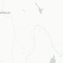
South Park is a small, unincorporated community in Teton County, Wyoming, situated south of Jackson in the broad valley that locals sometimes call the South Park area — not to be confused with the Colorado park of the same name or the television show. With a population of roughly 1,700, it is a quiet, working residential and ranching area rather than a conventional tourist destination.
The setting is genuinely dramatic. The community sits within sight of the Teton Range to the west and the Gros Ventre Range to the east, and the Snake River corridor runs nearby. Visitors who find themselves here are typically seeking solitude, wildlife observation on the valley floor, or a more affordable base from which to access the world-class attractions of Jackson Hole.
Because South Park is essentially a residential area rather than a developed town center, travelers should arrive with supplies, a plan, and realistic expectations. There is no downtown, no visitor center, and services are limited. Everything from lodging options to dining requires a short drive into Jackson or Hoback Junction.
Before You Go
Visas
South Park is located in the United States. For visa and entry requirements, visit TravelerPulse's Visas section and consult the U.S. Customs and Border Protection or U.S. Department of State official websites for current rules applicable to your nationality.
Seasons and weather
Wyoming's mountain climate means weather can change rapidly at any time of year. Summers (June–August) are warm and dry with occasional afternoon thunderstorms. Winters are long and cold, with significant snowfall typically from November through March. Spring (April–May) can be muddy with road closures on unpaved routes. Always check road conditions before traveling, particularly on Forest Service roads in the area.
What to pack
- Layered clothing regardless of season
- Sun protection at altitude
- Bear spray if hiking into adjacent public lands (verify regulations with the U.S. Forest Service or Wyoming Game and Fish)
- A detailed paper or offline map — cell coverage can be unreliable in the valley
- Sufficient fuel and supplies, as services thin out quickly outside Jackson
Getting There
By air
The nearest commercial airport is Jackson Hole Airport (JAC), located north of Jackson and roughly 10–15 miles from the South Park area. It is one of the few commercial airports inside a U.S. national park boundary. Rental cars are available at the airport; verify availability and pricing directly with rental agencies.
By road
South Park is reached primarily via US-89/US-191, the main highway running through Jackson Hole. From Jackson, drive south on US-89 and watch for South Park Loop Road and related community roads branching off the highway. Road signs are limited; use GPS coordinates or an offline map.
By bus
StartStop and regional ground transportation options connect Jackson to Salt Lake City and other regional hubs. Verify current schedules locally, as service changes seasonally. There is no public transit serving the South Park residential area itself.
Getting Around
A personal vehicle is essentially required in and around South Park. There is no local transit, and ride-share availability is limited even in Jackson. Roads within the community are a mix of paved highway and unpaved county roads; a standard passenger car suffices in summer, but winter driving conditions demand caution and appropriate tires.
Jackson itself is about 8–12 miles north depending on your exact starting point, and most amenities — grocery stores, gas stations, restaurants, medical care — are there. Hoback Junction, a small crossroads community, is a shorter drive south and has minimal services. Plan all trips with fuel and time in mind.
Where to Stay
South Park itself has no hotels or motels. Accommodation options take two main forms: short-term vacation rentals (cabins, ranch-style homes, and residential properties listed on booking platforms) within the South Park area, and a full range of lodging in Jackson, from budget motels to upscale lodges.
Camping is available on adjacent Bridger-Teton National Forest lands and at designated campgrounds in the broader Teton County area. Verify specific campground locations, availability, reservation requirements, and fees with the U.S. Forest Service or Recreation.gov before your trip, as sites fill quickly in summer.
Booking well in advance is strongly recommended if traveling between June and September, as the entire Jackson Hole valley sees high demand during the summer tourist season.
Things to See & Do
Wildlife watching
The valley floor around South Park is known for wildlife sightings. Elk, mule deer, moose, sandhill cranes, and a variety of raptors are regularly spotted in the open sagebrush flats and river corridor. Early morning and dusk are peak viewing times. Always observe animals from a safe and legal distance.
Access to public lands
The Bridger-Teton National Forest borders much of Teton County, and trailheads providing access to hiking, horseback riding, and fishing are within reasonable driving distance. The Gros Ventre Wilderness and surrounding forest lands are popular with backcountry visitors. Check current conditions and any permit requirements with the Bridger-Teton National Forest office in Jackson before heading out.
Snake River and fishing
The Snake River flows through the Jackson Hole valley and is a noted blue-ribbon trout fishery. Guided float trips and wade fishing are popular activities; outfitters are based in Jackson. Wyoming fishing licenses are required and available through the Wyoming Game and Fish Department — verify current regulations and fees on their official site.
Day trips
South Park's primary appeal for travelers is proximity to major attractions: Grand Teton National Park (roughly 20–30 miles north), Yellowstone National Park (roughly 60–70 miles north via US-89/191/287), and the town of Jackson for shopping, dining, and cultural activities.
Food & Drink
There are no restaurants or bars within the South Park residential community itself. All dining options require a drive to Jackson, approximately 8–12 miles north, where a wide range of restaurants, cafes, and bars operate to serve both locals and the large tourist population. Hoback Junction has very limited options; do not rely on it as a primary food source.
If staying in a rental home or camping nearby, purchasing groceries in Jackson before returning is strongly advised. The town has multiple grocery stores and a natural foods market. Verify hours locally, as they can shift seasonally.
Practical Information
Emergency services
For emergencies, dial 911. Teton County Sheriff's Office and St. John's Medical Center in Jackson provide the primary emergency response and healthcare for the area. Verify non-emergency contact numbers locally.
Cell coverage and connectivity
Cell service can be inconsistent in parts of the valley and is generally poor once you leave the main highway corridor. Download offline maps and key information before arriving.
Altitude
Jackson Hole valley sits at approximately 6,200 feet (about 1,890 meters) above sea level. Visitors unaccustomed to altitude may notice reduced stamina and should stay well hydrated, especially in the first 24–48 hours.
Pets
Leash laws and pet regulations apply on public lands. Wildlife encounters are a genuine concern; keep pets close and be aware of regulations in National Forest and adjacent protected areas.
Safety
South Park is a quiet residential community with no particular safety concerns beyond those common to rural Wyoming. The primary hazards are environmental: wildlife encounters (including bears, moose, and rattlesnakes in lower elevations), rapid weather changes, and the challenges of driving on mountain roads in winter.
If venturing onto public lands, inform someone of your itinerary, carry bear spray, and know how to use it. Moose are responsible for more injuries in the region than bears — give them a wide berth. Cell coverage gaps mean that self-sufficiency and preparation are important.
Winter driving on Wyoming roads requires experience or caution. Check Wyoming Department of Transportation road conditions (wyoroad.info) before traveling.