Translate
Overview
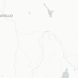
Driggs is a small town of roughly 1,700 people in Teton County on the western slope of the Teton Range in eastern Idaho. Sitting at around 6,100 feet elevation in the Teton Valley, it shares a mountain backdrop with the more famous Jackson Hole, Wyoming, just over Teton Pass to the east, but operates at a noticeably slower pace and lower price point.
The town serves as the primary base for Grand Targhee Resort on the slopes above, and draws skiers, snowboarders, hikers, mountain bikers, fly fishers, and wildlife watchers throughout the year. Agricultural land and wide-open meadows surround the town, giving it an authentic small-town feel rather than a resort-village aesthetic.
Driggs has a modest but functional Main Street with locally owned restaurants, outfitters, and a handful of services. Visitors typically pair a stay here with day trips into Grand Teton National Park (accessed from the Wyoming side), Grand Targhee, or the broader Caribou-Targhee National Forest.
Before You Go
Visas
Driggs is in the United States. For visa requirements, check TravelerPulse's Visas section and the official U.S. Customs and Border Protection website for guidance specific to your nationality.
Seasons and weather
- Winter (Dec–Mar): Cold, snowy, and ideal for skiing. Temperatures regularly drop below freezing at night. Grand Targhee is renowned for heavy, consistent snowfall.
- Spring (Apr–May): Muddy and unpredictable; some trails remain closed. A quieter, lower-cost shoulder season.
- Summer (Jun–Sep): Warm days (typically 70–85°F / 21–29°C), cool nights. Peak season for hiking, cycling, and outdoor events.
- Fall (Oct–Nov): Foliage is attractive; crowds thin considerably. Early snowfall possible.
Packing tips
- Layers are essential year-round; mountain weather changes quickly.
- Sun protection (sunscreen, sunglasses, hat) matters at elevation even on overcast days.
- If visiting in winter, pack proper snow boots and warm outerwear; bring or rent ski gear locally.
- Cell coverage can be limited outside town; download offline maps before arrival.
Getting There
By air
The closest commercial airports are Idaho Falls Regional Airport (IDA), approximately 75 miles southwest, and Jackson Hole Airport (JAC) in Wyoming, approximately 45 miles east via Teton Pass (Highway 22). Jackson Hole Airport tends to have more flight options but involves crossing a mountain pass that can close or require chains in winter. Idaho Falls is lower elevation and generally more reliable in winter weather.
Salt Lake City International Airport (SLC), roughly 275 miles south, is another option for travelers who want more flight choices and are willing to drive.
By car
Driggs is accessed primarily via State Highway 33 through Teton Valley. From Idaho Falls, take US-26 east and then ID-33 north. From Jackson, Wyoming, cross Teton Pass on Highway 22/ID-33. Rental cars are available at both regional airports. A high-clearance or all-wheel-drive vehicle is strongly recommended in winter.
By bus / shuttle
Verify locally for current shuttle or bus service options between Driggs and Jackson Hole or Idaho Falls, as schedules and operators change seasonally.
Getting Around
Driggs itself is compact and walkable in the immediate town center. However, reaching Grand Targhee Resort (about 12 miles up the mountain road), the national forest, or Grand Teton National Park requires a vehicle.
A free shuttle service has historically run between Driggs and Grand Targhee Resort during ski season — verify the current schedule directly with Grand Targhee before your trip, as service and timing can change. Outside of ski season, no meaningful public transit serves the area.
Bicycles are practical within town and on local paths in summer. For everything else, plan on having your own car or arranging a ride.
Where to Stay
Accommodation in Driggs ranges from vacation rentals and small inns to bed-and-breakfasts. Grand Targhee Resort has its own slopeside lodging options that are convenient for ski trips but tend to be priced at a resort premium. Vacation rental platforms typically list a range of cabins and houses in and around Driggs, which can be cost-effective for groups or families.
Book well in advance for holiday periods and peak ski weekends (particularly around Christmas, New Year's, and Presidents' Day). Summer demand has increased in recent years, so advance booking for July and August is also advisable.
Compared to Jackson Hole, Driggs generally offers lower accommodation prices for equivalent comfort, which is one reason many travelers choose to base themselves on the Idaho side of the Tetons.
Things to See & Do
Skiing and snowboarding
Grand Targhee Resort is the region's anchor attraction in winter. It is known for consistent deep powder, relatively uncrowded slopes compared to resorts of similar quality, and a relaxed atmosphere. Lift tickets, rentals, and lessons are available on-site; verify current pricing and hours directly with the resort.
Hiking and mountain biking
The Caribou-Targhee National Forest offers extensive trails accessible from Driggs in summer. The area around Grand Targhee also opens lift-served mountain biking when snow clears. Popular hiking destinations include Peaked Mountain and various trails within the national forest — trail conditions vary by season, so check with the U.S. Forest Service or local outfitters before heading out.
Wildlife and scenery
Teton Valley is excellent for wildlife watching, particularly at dawn and dusk. Pronghorn, elk, deer, and moose are frequently spotted in the surrounding fields and foothills. The west-facing Teton Range views from Driggs are dramatic, especially at sunset.
Cycling
The valley floor has relatively flat terrain, making road cycling accessible. The Teton Valley Trail network connects some communities; verify current trail status locally.
Fishing
The Teton River and its tributaries provide fly fishing opportunities. Local outfitters can arrange guided trips and supply gear.
Grand Teton National Park
While technically accessed from the Wyoming side, Grand Teton National Park is within roughly an hour's drive (road and weather permitting). It offers world-class scenery, hiking, and wildlife viewing. Entry fees apply; check the National Park Service website for current details.
Food & Drink
Driggs has a modest selection of locally owned restaurants and cafés for a town its size. Expect casual, unpretentious dining rather than fine dining. Options include American comfort food, pizza, and some Western-style fare. The selection expands somewhat at Grand Targhee Resort's on-mountain dining during ski season.
Grocery options in town are limited; a larger supermarket is available in nearby Rexburg or Idaho Falls if you need to stock up for a longer stay. There is a local natural foods cooperative (verify current status locally).
Craft beer is popular in the region; a small number of local establishments carry regional Idaho and Wyoming craft beers. Idaho is not especially known for wine production, but standard wine selections are available in restaurants and at liquor stores.
For the widest dining variety in the region, many visitors make day trips into Jackson, Wyoming, which has a much larger and more varied food scene.
Practical Information
Money
Driggs has ATM access; carry some cash as smaller local businesses may not accept all card types. Credit cards are widely accepted in established businesses and at Grand Targhee.
Cell service and internet
Coverage within town is generally adequate with major U.S. carriers, though it drops off in surrounding mountain and forest areas. Download maps, trail guides, and weather apps before venturing out.
Altitude
Driggs sits at roughly 6,100 feet (about 1,860 meters). Some visitors experience mild altitude-related symptoms such as headaches or fatigue, especially in the first day or two. Stay well hydrated and avoid strenuous exertion on your first day if you are arriving from low elevation.
Emergency services
For emergencies in the United States, dial 911. The nearest hospital with full services is in Idaho Falls; verify the location of the nearest urgent care clinic locally before you need it.
Tipping
Standard U.S. tipping practices apply: 15–20% at sit-down restaurants, and customary amounts for guides, ski instructors, and other service providers.
Safety
Driggs is a small, low-crime community. General awareness is sufficient for personal safety in town.
The primary safety concerns are environmental and outdoor-related:
- Winter driving: Teton Pass (Highway 22) and the road to Grand Targhee can be treacherous in snow and ice. Check road conditions through the Idaho Transportation Department or Wyoming DOT before driving. Chains or adequate snow tires are sometimes required.
- Avalanche awareness: Backcountry skiers and snowshoers should check the Bridger-Teton Avalanche Center forecast before going into uncontrolled terrain. Take an avalanche safety course and carry appropriate rescue equipment if you venture into the backcountry.
- Wildlife: Maintain safe distances from all wildlife, including moose, which can be aggressive. Bears are present in the national forest; carry bear spray when hiking in summer and follow Leave No Trace food storage guidelines.
- Weather changes: Mountain weather can shift rapidly. Always carry extra layers, water, and a map when hiking or biking away from the town center.