Overview
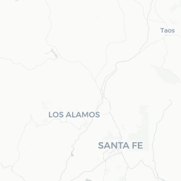
East Pecos is a small, unincorporated community of roughly 750 people situated in San Miguel County, New Mexico, about 25 miles southeast of Santa Fe along the I-25 corridor. Nestled at the foot of the Sangre de Cristo Mountains where the high desert gives way to ponderosa pine forest, it sits at an elevation of approximately 7,000 feet — a fact that shapes everything from its climate to its outdoor appeal.
The community is largely residential and agricultural, with no significant commercial downtown district of its own. Its draw for travelers is almost entirely geographic: it puts visitors within minutes of Pecos National Historical Park, the Pecos Wilderness, and the upper Pecos River, one of New Mexico's most prized trout fisheries. The nearby town of Pecos (immediately adjacent) provides what limited services exist in the area.
This is not a destination built for luxury tourism. Visitors who get the most out of it tend to be hikers, anglers, history enthusiasts, or people using the area as a quieter, more affordable base for exploring northern New Mexico rather than staying in Santa Fe itself.
Before You Go
Visas
East Pecos is in the United States. For visa and entry requirements, check TravelerPulse's Visas section and the official U.S. Customs and Border Protection website.
Altitude
At roughly 7,000 feet, altitude can affect visitors arriving from sea level. Allow a day to acclimatize, stay well hydrated, and limit strenuous activity on your first day. Those with heart or respiratory conditions should consult a physician before travel.
What to Pack
- Layered clothing: mornings and evenings can be cool even in midsummer
- Sun protection (sunscreen, hat, sunglasses) — UV intensity is high at elevation
- Sturdy hiking footwear if you plan to enter the Pecos Wilderness
- A New Mexico fishing license if you intend to fish the Pecos River (verify current licensing requirements with New Mexico Department of Game and Fish)
Connectivity and Services
Cell coverage can be spotty in the canyon areas around the Pecos River. Download offline maps before arrival. There are no large grocery stores or pharmacies in East Pecos itself; stock up in Santa Fe or Las Vegas, NM before arriving.
Getting There
By Car
East Pecos is most practically reached by car. From Santa Fe, take I-25 South to Exit 299 (NM-50), then head east through the town of Pecos — roughly a 30-minute drive. From Albuquerque, the drive north on I-25 takes approximately 90 minutes. A standard passenger vehicle is adequate for most routes; a higher-clearance vehicle is useful if you plan to explore unpaved forest roads.
By Air
The nearest commercial airport is Santa Fe Regional Airport (SAF), about 30 miles west. Albuquerque International Sunport (ABQ), roughly 90 miles southwest, offers more flight options and major carrier service. Car rental is strongly recommended at either airport, as there is no meaningful public transit connecting to East Pecos.
Public Transportation
There is no scheduled public bus or shuttle service to East Pecos. The New Mexico Rail Runner Express connects Albuquerque to Santa Fe, but onward travel from Santa Fe to East Pecos still requires a private vehicle or rideshare arrangement. Verify rideshare availability locally, as coverage in rural areas can be unreliable.
Getting Around
A personal vehicle is essentially required for getting around East Pecos and its surroundings. There is no local transit, and distances between trailheads, the national historical park, and any services are not walkable for most visitors.
NM-50 is the main paved corridor through the area. Forest roads branching off into the Santa Fe National Forest range from well-graded gravel to rough four-wheel-drive tracks — check road conditions with the Pecos/Las Vegas Ranger District of Santa Fe National Forest before venturing onto unpaved routes, especially after rain or in early spring when roads can be muddy or washed out.
Where to Stay
Accommodation options in East Pecos and immediate Pecos are limited. The area has a handful of vacation cabin rentals along the Pecos River canyon, which can be found through short-term rental platforms — these tend to book up well in advance during summer fishing season and fall foliage season (late September–October).
For travelers who prefer hotels, Santa Fe offers the widest range of options from budget motels to boutique properties and is a reasonable 25–30 minute commute. Las Vegas, NM, to the southeast, also has basic motel accommodation at generally lower price points than Santa Fe.
Camping is available in Santa Fe National Forest in the Pecos area; established campgrounds include sites along NM-63. Fees and availability should be confirmed through Recreation.gov or the Santa Fe National Forest website, as sites may require advance reservation during peak summer months.
Things to See & Do
Pecos National Historical Park
The primary cultural attraction in the area, this park preserves the ruins of Pecos Pueblo — a major ancestral Puebloan and later Spanish colonial mission complex with origins dating back to around 1100 CE. A well-maintained trail loops through the main ruins, and the visitor center provides archaeological and historical context. Admission fees and hours vary; verify current information at nps.gov/peco before your visit.
Pecos Wilderness
One of the largest wilderness areas in New Mexico, the Pecos Wilderness covers over 223,000 acres of the Sangre de Cristo Mountains. Trailheads accessible from the East Pecos and Pecos area lead into alpine terrain with lakes, meadows, and peaks exceeding 13,000 feet. Trails range from short day hikes to multi-day backpacking routes. Permits and regulations can be checked with the Santa Fe National Forest.
Pecos River Fishing
The upper Pecos River is a designated Wild and Scenic River and one of New Mexico's best trout streams, supporting brown and rainbow trout populations. Access points exist near the community. A valid New Mexico fishing license is required; verify current regulations and any seasonal closures with the New Mexico Department of Game and Fish.
Scenic Driving
NM-63 north of Pecos follows the river through dramatic canyon and forest scenery before entering national forest land. Even without hiking, the drive itself rewards visitors with views of the Sangre de Cristos and the river corridor.
Food & Drink
East Pecos itself has essentially no restaurant or bar scene. The adjacent town of Pecos has a small number of local establishments; verify what is currently open before counting on specific spots, as businesses in small rural communities can change.
For a broader dining selection, Santa Fe is 25–30 minutes away and offers everything from New Mexican cuisine (green and red chile dishes, posole, tamales) to fine dining and international options. Las Vegas, NM, roughly 30 miles southeast on I-25, also has local diners and basic restaurants.
If you are staying in a cabin or camping, consider bringing your own supplies from Santa Fe or Albuquerque. A small general store in the Pecos area may carry basics, but availability and hours should be confirmed locally.
Practical Information
Emergency Services
For any emergency in the United States, dial 911. The nearest hospital with full emergency services is in Santa Fe; verify the specific facility with local authorities or your accommodation host.
Weather
East Pecos experiences a four-season mountain climate. Summers are mild with afternoon thunderstorms common from July through August (the regional monsoon season) — plan outdoor activities for mornings. Winters bring snow, and road conditions on NM-63 and forest roads can deteriorate significantly. Check NMDOT road conditions (nmroads.com) in winter months.
Water
Tap water is generally safe to drink from municipal sources. If camping or hiking in the backcountry, treat or filter all surface water before consumption.
Cell Service
Expect gaps in coverage, particularly in the river canyon and wilderness areas. Inform someone of your plans before backcountry trips.
Safety
East Pecos is a quiet rural community with no notable crime concerns for travelers. Standard rural travel awareness applies: let someone know your hiking or backcountry plans, carry adequate water and food, and do not rely solely on cellular navigation in areas with poor signal.
Wildlife in the Sangre de Cristo Mountains includes black bears and mountain lions. Follow standard wildlife safety protocols: store food properly when camping, do not approach wildlife, and make noise on trails to avoid surprising animals. The New Mexico Department of Game and Fish publishes current wildlife safety guidance.
Altitude-related illness (headache, nausea, fatigue) is a genuine risk, especially for visitors coming quickly from low elevations. Descend to lower elevation if symptoms worsen.