Translate
Overview
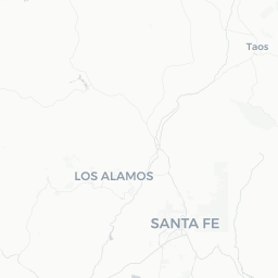
Pecos is a small village of roughly 1,300 people situated in the upper Pecos River valley, about 25 miles southeast of Santa Fe along I-25. Tucked between the Sangre de Cristo Mountains and the high desert plains, it sits at an elevation of approximately 7,000 feet and combines dramatic scenery with deep layers of history spanning centuries of Pueblo, Spanish colonial, and Anglo-American presence.
The community is best known as the home of Pecos National Historical Park, which preserves the ruins of one of the largest pre-Columbian pueblos in the Southwest and two Spanish colonial missions. Beyond the park, the Pecos River draws anglers and hikers, and the Santa Fe National Forest surrounds the valley on multiple sides, offering extensive backcountry access.
Pecos itself has minimal commercial infrastructure — no large hotels, few restaurants, and no major shopping. Most visitors either day-trip from Santa Fe or use the village as a quiet base for outdoor pursuits. That simplicity is part of its appeal for travelers seeking solitude and genuine connection with the landscape.
Before You Go
Visas and Entry
Pecos is in the continental United States. Entry requirements depend on your nationality. Check TravelerPulse's Visas section and the U.S. Customs and Border Protection website for current requirements before traveling.
What to Pack
- Sun protection is essential at high elevation even on overcast days
- Layers: mornings and evenings can be cool even in midsummer; afternoon thunderstorms are common June through August
- Sturdy walking shoes for unpaved trails at the historical park
- Cash — some local businesses do not accept cards; verify locally
Health Notes
The altitude (around 7,000 ft / 2,130 m) can affect visitors arriving from lower elevations. Allow a day to acclimatize if you are coming from sea level, stay hydrated, and limit strenuous activity initially. Afternoon lightning storms in monsoon season (July–August) are frequent; get off exposed ridges and trails before they build.
Getting There
By Car
Pecos is the most practical way to arrive. From Santa Fe, take I-25 east to exit 299 (NM-50), then follow NM-50 east into the village — roughly a 30-minute drive. From Albuquerque, take I-25 north toward Santa Fe and continue to the same exit; total drive time is approximately 90 minutes under normal conditions.
By Air
The nearest commercial airport with regular scheduled service is Santa Fe Regional Airport (SAF). Albuquerque International Sunport (ABQ) is larger, offers more routes, and is roughly 90 miles away. Car rental at either airport is the standard onward connection to Pecos — verify availability and book in advance, especially during summer.
By Bus
There is no direct public bus service into Pecos village. Regional services to Santa Fe exist from several New Mexico cities; from Santa Fe you would need a rental car or rideshare to reach Pecos. Verify current schedules with New Mexico's North Central Regional Transit or other providers.
Getting Around
A personal vehicle is effectively required once in Pecos. The village is small, and the key sites — the national historical park, river access points, and trailheads — are spread across several miles of road. There is no local bus service and no taxi stand.
Rideshare apps (Uber, Lyft) have limited coverage in rural San Miguel County; do not rely on them. If you arrive without a car, confirm transportation arrangements in advance. Roads in the area are generally paved and well-maintained, though some forest service roads accessing backcountry trailheads are unpaved and may require higher clearance — check conditions locally or with the Santa Fe National Forest before heading out.
Things to See & Do
Pecos National Historical Park
This is the primary cultural attraction in the area. The park preserves the multi-story Pecos Pueblo, occupied for centuries before its abandonment in 1838, and the ruins of two successive Spanish Franciscan missions built in the 17th and 18th centuries. A 1.25-mile self-guided trail loops through the ruins. The visitor center provides archaeological and historical context. Entry fees and hours apply — verify current details on the National Park Service website (nps.gov/peco) before visiting.
Pecos River Fishing and Hiking
The upper Pecos River is one of New Mexico's most productive trout streams. The river and its tributaries run through the Santa Fe National Forest and are accessible from several points along NM-63, which heads north from the village. Fishing requires a valid New Mexico fishing license; check current regulations with New Mexico Game and Fish. Trails along the river corridor also offer pleasant day hikes.
Glorieta Battlefield
A unit of Pecos National Historical Park, Glorieta Battlefield preserves the site of a pivotal Civil War engagement fought in March 1862 that effectively halted a Confederate advance into New Mexico. The battlefield is west of the village near Glorieta Pass. Access and facilities are limited; verify current conditions with the park service before visiting.
Santa Fe National Forest
The forest surrounding Pecos offers backcountry hiking, camping, and in winter, cross-country skiing and snowshoeing. The Pecos Wilderness within the forest is one of the larger wilderness areas in New Mexico. Trailheads near the village provide access to alpine terrain. Obtain current trail and road conditions from the Pecos/Las Vegas Ranger District office.
Food & Drink
Food and drink options in Pecos are limited given the village's small population. There are a handful of small local establishments along NM-50 and NM-63 that serve New Mexican and American fare; availability can vary by season and day of the week, so verify hours locally before relying on any specific place.
Most visitors staying multiple days bring their own groceries or stock up in Santa Fe before arriving. The nearest significant grocery stores and a full range of restaurants are in Santa Fe, roughly 25 miles west. If you plan to spend full days outdoors, packing a lunch and snacks is practical rather than optional.
New Mexico has a strong green and red chile tradition. If a local diner is open, ordering a chile-based dish is a reasonable way to experience regional food culture. When in doubt, ask for both — the local answer to "red or green?" is "Christmas."
Practical Information
Emergency Services
For emergencies anywhere in the United States, dial 911. The nearest hospital with full emergency services is in Santa Fe. Verify the location of the nearest urgent care facility locally upon arrival.
Connectivity
Cell coverage in Pecos and the surrounding river valley is inconsistent. Major carriers have varying signal strength; coverage typically weakens further up NM-63 into the mountains. Download offline maps (Google Maps, Maps.me, or similar) before leaving Santa Fe. The national park visitor center may have Wi-Fi — verify locally.
Fuel
Gas up before arriving or at the limited options in the village. Do not assume fuel will be available late at night or that prices will match urban areas.
Weather Awareness
Monson season runs roughly July through September. Afternoon thunderstorms can develop rapidly. Check the National Weather Service forecast (weather.gov) daily when planning outdoor activities. Winter can bring snow and icy roads on NM-63; conditions can close upper road sections — check with the New Mexico Department of Transportation before traveling in cold months.
Safety
Pecos is a quiet rural community with no particular safety concerns for visitors. Standard rural travel precautions apply: carry more water than you think you need on hikes, tell someone your plans if heading into the backcountry, and be aware that cell service for calling emergency services may be unavailable in forested areas.
Wildlife is present in the surrounding forest, including black bears and mountain lions. Follow standard bear-country protocols when camping or hiking: store food properly, make noise on trails, and do not approach wildlife. The Santa Fe National Forest and Pecos Wilderness trail information includes current wildlife advisories — check before heading out.